|
CAVE
RUN HOME | DOWNLOADS |
HOME |

|
 |
Bird's Eye View 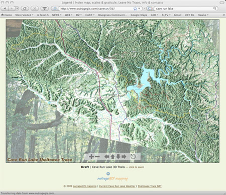
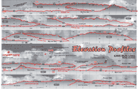
A draft of a Bird's Eye View of the Cave Run Lake trails and the Sheltowee Trace from the northern terminus and Corner Ridge. Map is not finished and not entirely labeled, but it shows the terrain pretty well. View map Trail Elevation Profiles
|
||||
| HOME | CONTACT | THE
SCIENCE OF MAPPING - THE ART OF CARTOGRAPHY |
|||
outrageGIS mapping | PO Box 2054 | Lexington, KY 40588
![]()