Introducing the Great Smoky Mountains Trail PDF Map
Use this map on your iOS or Android mobile device.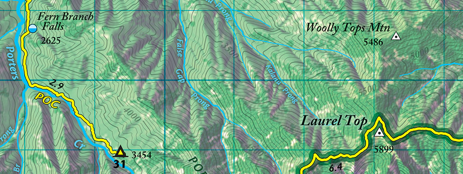
Mobile Map
This detailed trail map has GPS mapped trails, backcountry campsites, and many other features for exploring the Smokies.
Map has coupon code for downloading the GPS Data Pack and extends the use of your unit in the field.
1) Download Free App
2) Visit Avenza Map Store
Find our maps by searching for "outrageGIS" through the Avenza PDF Maps App and select your map.
After installation, you can use our maps without cell service or Wi-Fi. You can log and export your GPS tracks, waypoints, and photos.
2009 Trail Atlas Contents
The atlas helps hikers and equestrians enjoy the varied geography, ecology, and history of this wonderful park. The atlas packs in a 4.5" x 6" x 3/8" kit that is durable and waterproof.
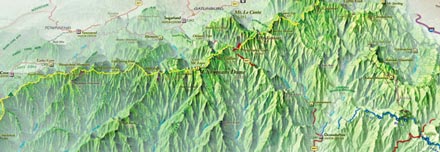
- 1:96,500 scale GPS trail map with elevations, forest canopy type, and lattitude and longitude grid.
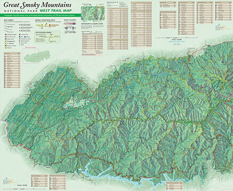
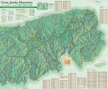
three full-color sheets at 18.5" x 13"
- A 3D map offers a Bird's Eye View of the park and is a quick, intiutive way to visualize the topography of the park.
one full-color sheet at 18.5" x 13"
- 1:192,000 scale map shows Camping in the park and is great for the early stages of planning your backpack trip.
one two-color sheet at 18.5" x 13"
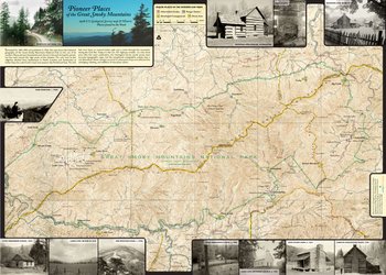
- A historic topographic map the shows Pioneer Places in the park and the area on the eve of the park's creation.
one full-color sheet at 18.5" x 13"
- A 32-page trail gazetteer booklet that gives exact location of trailheads, trail intersections, backcountry campsites, and scenic areas. Gives trail users cumulative elevation gains and losses.
32-page booklet at 6" x 4.5"
- Free GPS Data Pack download with GPX track and waypoint files for trails and destinations in the park. Includes expanded gazetteer and special topographic mapbook.
36-megabyte download only
View this Map
The most complete and handsome trail map you'll carry in the backcountry.
This innovative atlas contains full-color GPS trail maps, evergreen and deciduous canopy cover, backcountry scenic sites, historic and 3D maps, a gazetteer booklet, and a GPS data pack web download.
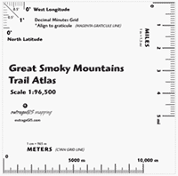 Download and print map scale and measurement tool. Note, this scale is included in the atlas. Print it at home and use in the woods to more precisely locate yourself with a GPS unit set to DD MM.MMM, on a UTM grid, or just measure linear distance.
 View an interactive Bird's Eye View map (requires Flash)
Our Recent Photographs & Maps

Images of Maps
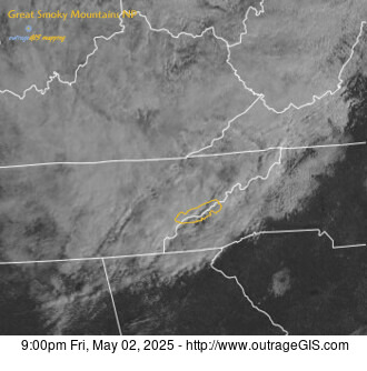
Weather maps and data for GSMNP
Our Favorite Hikes

 Great Smokies Trail Atlas
Distance: 9 Miles round-trip from trailhead
Difficulty: +++
Scenic Views: +++
Elevation Relief: 1,800ft ^^
Ownership: Great Smoky Mountains, NPS
| Great Smokies Trail Atlas: $14 |
 |
As you drive from the Sugarlands Visitor Center on Newfound Gap Road, you’ll catch gl...
Our Great Smokies Blog
We collect imagery from national park webcams in the Great Smokies and Mammoth Cave parks and the...
 Visit the page to
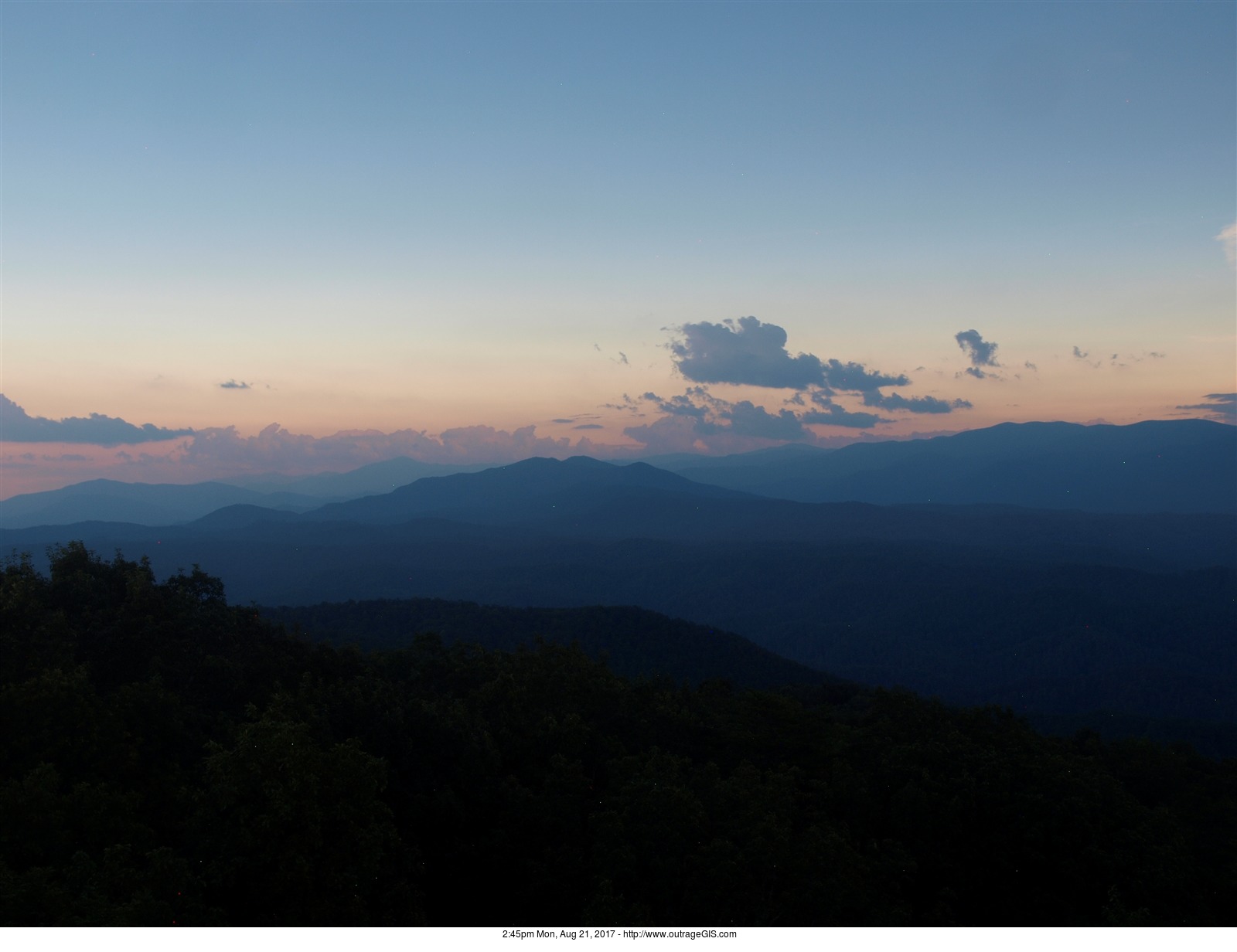
2:45pm looking across Rich Mountain and Cades Cove
For over a decade we’ve collected views from r...
Our Clients' Maps

Click to open map
On September 20, 2014 a downtown Lexington neighborhood hosted a block party and potluck. Raffles were held, which indeed include...

Click to view
A slippy map that shows alumni districts for the University of Kentucky. A shapefile of the districts was simplified with polygon ...
