| Lexington Jogger's Street Atlas Two Types |
|

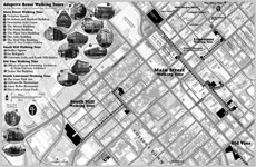 |
Lexington Historic Downtown Walking Tour |
|
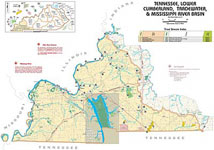
KY Boating Access Sites |
|
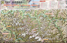 |
Red River Gorge 3D Trail Map |
First Frontier Audio Driving Tour (mp3 and pdf) Listen to Introduction (3 meg .mp3) visit webpage: firstfrontier.org |
|

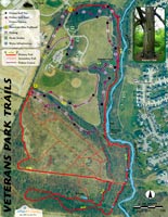 |
Veteran's Park Trail Map |
At Leisure's Edge visit webpage: uky.edu/Projects/TDA |
|