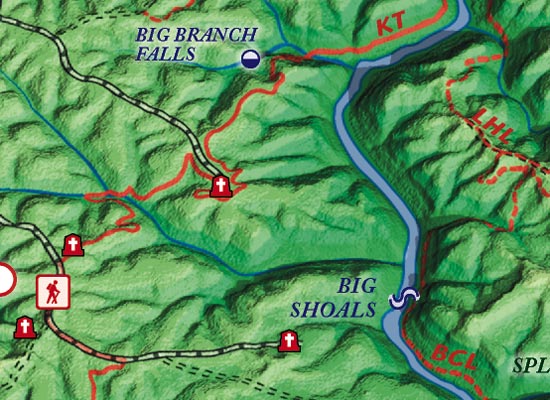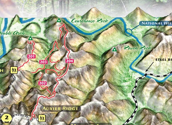
Orthographic 3D maps crafted for hiking and exploring Kentucky's forest and park areas. We build our maps from DEMs with custom elevation tints, relief, and landscape effects. We often show roads, trails, and detailed hydrography. We create the high-resolution 3D raster basemaps with POVRay.
All of our 3D views use scene lighting effects that approximates the sun angle of a fall day in Kentucky.
|
 Aerial
Photography (4 SAMPLES)
3D Cartography (5 SAMPLES) USGS Topo 3D (3 SAMPLES) Take our descriptive 3D product tour via Flash™
|