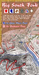
Topographic Trail Maps for the Big South Fork National River and Recreation Area. A guide for the adventurer, picture-taker, and nature lover. 7 maps in a durable, weatherproof pack for weekends of woodland romance.
Backcountry trails include the 45-mile John Muir Trail, the 25-mile southern terminus section of the Sheltowee Trace, the Kentucky Trail, Twin Arches Loop, Litton & Blevins Farm Loops, Pilot Wines & Big Island Equestrian Loops, Hidden Passage Loop, Rock Creek Loop, Leatherwood Ford Loop, Grand Gap Loop, Blue Heron Loop and trails around the Charit Creek Lodge area. Over 200 miles of trails mapped!
Scenic areas include Angel Falls Overlook, Sunset Overlook, O&W Bridge, Bronco Overlook, John Muir Overlook, Fall Branch, and No Business Creek.
|
|

Explore a land of arches, waterfalls, and rustic river views. Visit historic homesteads & coal camps. Hike to a gorge rim overlook and survey the wonder that is the Big South Fork.
|
|
$12 - Buy 
Includes GPS mapped trails, aerial photography, 50-ft topo contours, spot elevations, UTM & GEO GPS grids, and a JMT trail elevation profile. 4-mil poly Zipper bag.
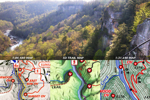
Samples |
This is what you get:
1:84,480 scale Overview Map. 6 spot-color, 18.5 x 13.5 inches. Shows all trails between O&W Bridge and Blue Heron with mile markers for the John Muir Trail and Sheltowee Trace.
1:31,640 scale Topo Maps. 5 spot-color, 18.5 x 13.5 inches, 2 Maps. Shows true mileage between intersections for all official trails. 50-ft elevation contours. Shows entire John Muir Trail and all intersecting trails.
3D Trail Map. Full-color, 18.5 x 13.5 in unique map showing trails, arches, waterfalls, and scenic destinaitons.
1:126,720 scale Recreation Map. 2-color, 18.5 x 13.5 map of all trails in Big South Fork area, including Pickett State Park, Stearns Ranger District in USFS, Rugby, and Darrow Ridge.
Online GPS Download. A companion site for the printed maps that helps you plan your trip. Includes downloadable GPS files and weekend backpacking suggestions.
AND MORE! See samples...
|
|