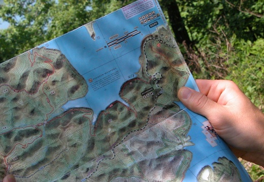
05 May 15: Cave Run Lake Knob Hopping Geocache
A good wilderness geocache is remote, difficult, and requires good navigation skills. This geocache has all these and weeds the wannabes from the Daniel (or Rebecca) Boone types. If you want 6-8 hours of up-and-down backwoods buccaneering start here: UTM:A good wilderness geocache is remote, difficult, and requires good navigation skills. This geocache has all these and weeds the wannabes from the Daniel (or Rebecca) Boone types. If you want 6-8 hours of up-and-down backwoods buccaneering start here: UTM: 17S E 277817 N 4218195 NAD83 or N38° 05.056, W083° 32.000 or goto: Sky High Knob Hopping at Cave Run Lake. Don't be a rude pirate and please tell me if you visit but do not log it geocache.com.
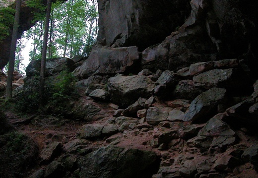
05 May 13: Red River Gorge Rough Trail, Gray's Arch
Gray's Arch is one of the well-known features in the Red River Gorge. The 10-mile Rough Trail loop is a great beginner's loop for backpacking. While it is busy on holiday weekends, through the week you may own this loop all to yourself.This area is covered in our Red River Gorge Trail Map:
[img]http://www.outragegis.com/store/images/T/th_Gorge.jpg[/img]
Buy this map
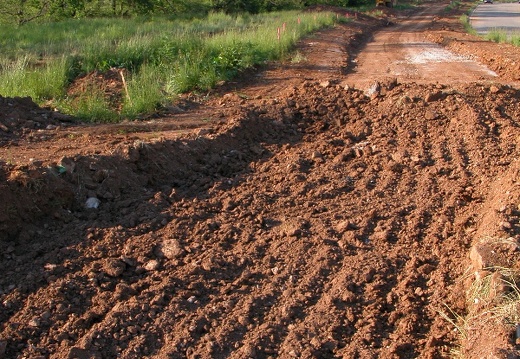
May: Town Branch Trail
10: A photo journal of Town Branch Trail's Phase I development. A physical awakening.
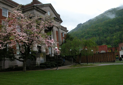
05 April 23-24: First Frontier Driving Tour
The First Frontier Driving Tour visits: Union College, Bell County Courthouse Square, Cumberland Gap National Historical Park, Pinnacle Overlook, Abraham Lincoln Library & Museum, Pine Mountain State Resort Park, Harlan County Courthouse Square, KingdThe First Frontier Driving Tour visits: Union College, Bell County Courthouse Square, Cumberland Gap National Historical Park, Pinnacle Overlook, Abraham Lincoln Library & Museum, Pine Mountain State Resort Park, Harlan County Courthouse Square, Kingdom Come State Resort Park, Little Shepherd Trail, & Ravens Rock
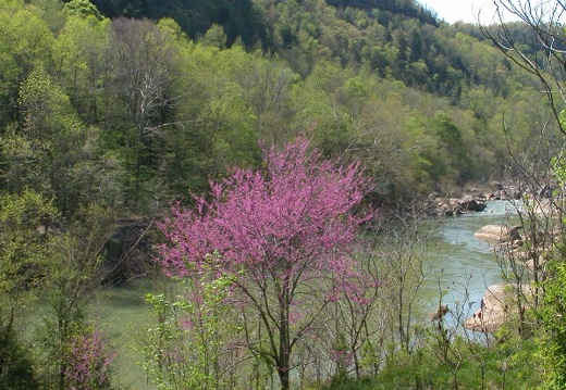
05 April 17-18: Beaver Creek Wilderness, Blue Heron
Beaver Creek Wilderness Area, one of two in Kentucky, has a loop hike to the Three Forks of the Beaver Overlook and down to stream level. Remote with not much trail at bottom, but there is a nice camp. Blue Heron Loop at the Big South Fork to the KentukyBeaver Creek Wilderness Area, one of two in Kentucky, has a loop hike to the Three Forks of the Beaver Overlook and down to stream level. Remote with not much trail at bottom, but there is a nice camp. Blue Heron Loop at the Big South Fork to the Kentucky Trail to Catawba and Dick Gap Overlooks. Visited Devil's Jump and Crack in the Rocks
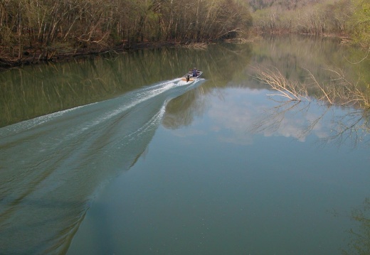
05 April 9-10: Laurel Lake and the mouth of the Rockcastle River
Camped first night near White Oak campground at Laurel Lake. Hiked Cold Rock School Trail then the Corps of Engineers Laurel Lake dam and spillway trail. Camped at Bee Rock and visited the Sublimity Bridge Overlook for sunset. Hiked the loop around the moCamped first night near White Oak campground at Laurel Lake. Hiked Cold Rock School Trail then the Corps of Engineers Laurel Lake dam and spillway trail. Camped at Bee Rock and visited the Sublimity Bridge Overlook for sunset. Hiked the loop around the mouth of Rockcastle starting at the Scuttle Hole Overlook. Connected Dutch Branch, Ned Branch, Twin Branch, and Lakeside trails for counterclockwise loop. The London Ranger District of the Daniel Boone National Forest.
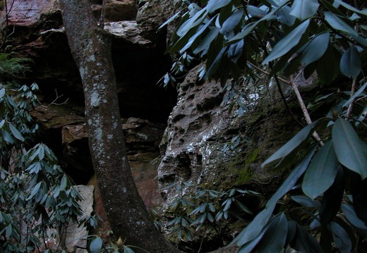
05 March 26: Sheltowee Trace south of I75 to Hawk's Creek Bridge
The trailhead at Sheltowee Trace mile 160 lists prohibitied vehicles. Because this is a county road any street legal vehicle can drive its length. Due to erosion of topsoil into the Rockcastle River, this playground has problematic impacts on the local enThe trailhead at Sheltowee Trace mile 160 lists prohibitied vehicles. Because this is a county road any street legal vehicle can drive its length. Due to erosion of topsoil into the Rockcastle River, this playground has problematic impacts on the local environment. In an ironic twist, this area has not succumbed to pine beatle epidemic. The Shelotwee leaves the county road and decends into a beautiful Hawk Creek gorge and suspension bridge.

05 March 24: Iroquois Park, Louisville, KY
Iroquois Park is an Olmsted park and offers some of the best views in Louisville. The perimeter trails are the longest unbroken woodland trails in Louisville.

05 March 18-19: Mt. Rogers and Radford University campus, VA
This trip is comprised of two journeys. The fist day is an exploration of Radford University's campus with a focus on outdoor sculpture. This small university has a top-notch arborist. Every tree seems well-tended and nurtured to make a stunning campus evThis trip is comprised of two journeys. The fist day is an exploration of Radford University's campus with a focus on outdoor sculpture. This small university has a top-notch arborist. Every tree seems well-tended and nurtured to make a stunning campus even in winter. The display of outdoor sculpture is gratifying. Day 2: Mt Rogers is the tallest mountain in Virginia at 5,750 feet. In summer this is a well-traveled part of the Appalachian Trail. On a blustery March day, the trail was vacant. From the Grindstone camp trailhead, the trail is 7 miles to the summit over 2,000 vertical feet. Every 250 vertical feet the snow pack increased about 2 inches. At the summit the pack was easily 2 feet with drifts up to the waist. While hikers often bemoan the absent big-sky view from the summit, the mountain still invites with, "Come and you will be Satisfied."
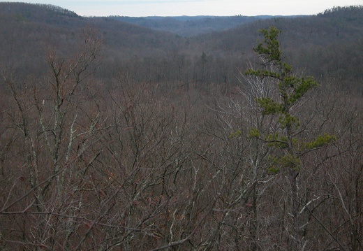
05 March 11: Gate Post Hill Arch, Sheltowee, at Cave Run
A bland winter day. This loop is about 8 miles from the furnace, then to the Furnace Arch, and then the gravel road back to the hardtop. A map makes it simple, plus you get a chance to bush-whack up to Gate Post Hill and *hump* the impressive arch....andA bland winter day. This loop is about 8 miles from the furnace, then to the Furnace Arch, and then the gravel road back to the hardtop. A map makes it simple, plus you get a chance to bush-whack up to Gate Post Hill and *hump* the impressive arch....and then visit the popular Clear Creek shooting range.
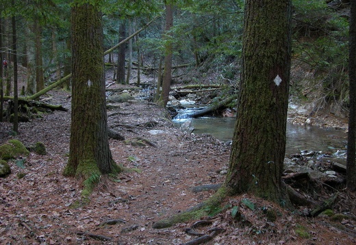
05 February 26: Red River Gorge
Winter hike from ridge to creek and back.This area is covered in our Red River Gorge Trail Map:
[img]http://www.outragegis.com/store/images/T/th_Gorge.jpg[/img]
Buy this map

05 February 19-20: Cumberland Falls to Laurel Lake
Tucked in the Cumberland River valley, the Sheltowee Trace passes numerous waterfalls and secluded ravines where hemlock and rhododendron grow profusely. Such examples are Devil's Creek, Dog Slaughter Falls, and Bear Camp Creek falls. BTW, the bridge acroTucked in the Cumberland River valley, the Sheltowee Trace passes numerous waterfalls and secluded ravines where hemlock and rhododendron grow profusely. Such examples are Devil's Creek, Dog Slaughter Falls, and Bear Camp Creek falls. BTW, the bridge across Bear Camp that was demolished in 2004 flooding, a 3/4" nylon rope now anchors opposite trees for a support line. Our trip of 8 hikers & 3 dogs ended at Laurel Lake's Holly Bay marina. Laurel Lake is the second largest lake in the Daniel Boone NF, behind Cave Run Lake. The two contrast: where Cave Run is shallow and silty, Laurel Lake is deep, cliffy, and clear.
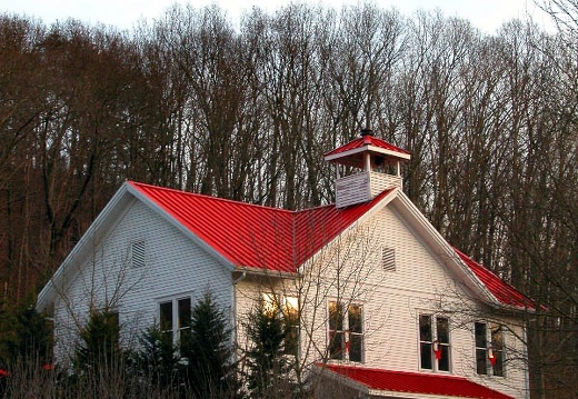
05 February 5: Siltstone Trail, Jefferson Co. Memorial Forest
A fleeting, mercurial taste of mountains...that's the quicksilver feeling you get on the Siltstone Trail. I am sure any kid with imagination will see these knobs of nearly 400-ft (of vertical relief) as cold and forbidding summits. Unlike eastern KentuckyA fleeting, mercurial taste of mountains...that's the quicksilver feeling you get on the Siltstone Trail. I am sure any kid with imagination will see these knobs of nearly 400-ft (of vertical relief) as cold and forbidding summits. Unlike eastern Kentucky's summits, the pine beetle hasn't molested the piney tops of this park. If only sandstone outcroppings existed. If you start at the Welcome Center and hike the Siltstone trail as an out-and-back, then you've climbed 3,630 ft of elevation over 12.6 miles. The forest has over 30 miles of trail with an approx. 10,000 ft of cumulative elevation change. This urban forest is so amazingly close to downtown Louisville that you could grab a Heine Brothers coffee, drink it still-warm at your first step on the Siltstone, and have a post-trail Wick's pizza and not spend more than 6 hours.
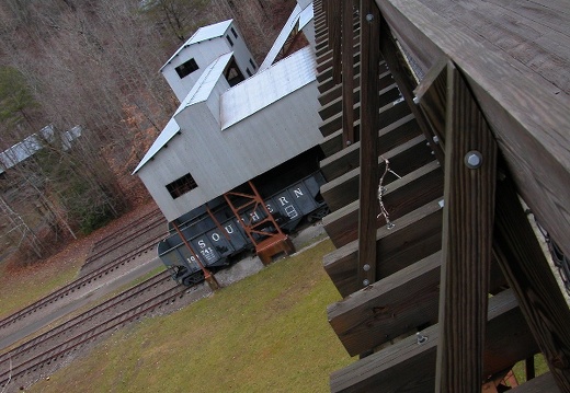
05 January 30: Kentucky Trail, Big South Fork
The northern terminus of the Kentucky Trail intersects the Sheltowee Trace on Wilson Ridge (above Yamacraw Bridge) in the Big South Fork. This 12.5 mile segment (of a total of 28 miles) bypasses the Blue Heron interpretive area. The bridge that crosses thThe northern terminus of the Kentucky Trail intersects the Sheltowee Trace on Wilson Ridge (above Yamacraw Bridge) in the Big South Fork. This 12.5 mile segment (of a total of 28 miles) bypasses the Blue Heron interpretive area. The bridge that crosses the Big South Fork river connecting Blue Heron with the trail was once a mining railcar bridge. Other evidence of former coal mining is abundant, such as capped portals and ruins of unknown structures. Despite this industrial past, the park offers one of few places that hikers can find lush green in a dead Kentucky winter.
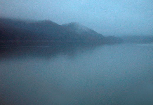
05 January 29: Cave Run Lake, Big Limestone, Lakeview
Trails above the Morehead District (Cave Run Lake) visitor center snake around some of the tallest knobs in the northern section of the Daniel Boone NF. Big Limestone is 4.5 miles on trail north of the visitor center and has about 750 feet of vertical relTrails above the Morehead District (Cave Run Lake) visitor center snake around some of the tallest knobs in the northern section of the Daniel Boone NF. Big Limestone is 4.5 miles on trail north of the visitor center and has about 750 feet of vertical relief...almost a textbook definition of a mountain. Atop Big Lime (and neighboring Little Lime) are large cylindrical outcroppings of eroded sandstone, nipple-like, with a nice set of crowning boulders, despite the heavy thrush of undergrowth. As one travels southward, the boulders become progressively cliffline and serpentine...geographically similar to the Red River Gorge. If you're looking for about 100 miles of singletrack and isolation, Cave Run is the destination.
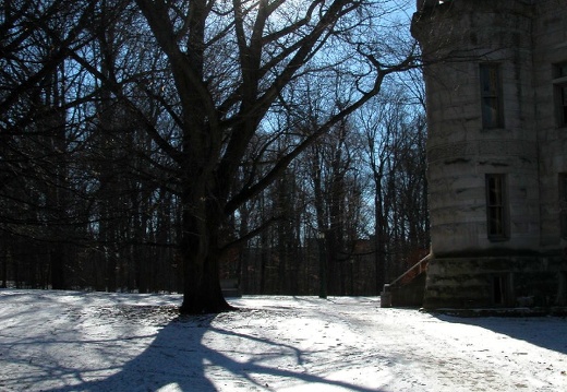
05 January 23: Indiana University, Bloomington town, Brown County SRP
Bloomington, Indiana, famous for abundant, fine-grained limestone quarries and hard-nosed cutters, men who harvested that limestone, is a true granola oasis in the rural woodlands of southern Indiana. This village-city is flanked by Hoosier National ForesBloomington, Indiana, famous for abundant, fine-grained limestone quarries and hard-nosed cutters, men who harvested that limestone, is a true granola oasis in the rural woodlands of southern Indiana. This village-city is flanked by Hoosier National Forest and Lake Monroe to the south, state parks to both its east, notably Brown County, and west, and state forests to the north and east. This crown of greenery is distilled and alliterated through Indiana University's picturesque campus. Dunn Woods and the Jordan River weave a pastoral collage between gothic academic structures, public sculptures, and Indiana's largest student population of 39,000. Between the courthouse square and campus, is Kirkwood Avenue, or 5th street, the backbone of Bloomington's watering holes. Like any oasis unfortunately, the town can be small and bone-dry in the summer.
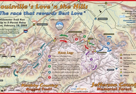
05 January 9: McConnell Loop in JCMF & Love'n the Hills
The McConnell Loop in Jefferson County Memorial Forest is an aerobic 5.5 miles. At night the glow of Louisville's skyline floods the knobby crests of the trail. This trail is about a 1/6 of the ultra run that starts at the Horine on Valentine's Day. DoThe McConnell Loop in Jefferson County Memorial Forest is an aerobic 5.5 miles. At night the glow of Louisville's skyline floods the knobby crests of the trail. This trail is about a 1/6 of the ultra run that starts at the Horine on Valentine's Day. Does your date need a map? http://www.outragegis.com/jcmf/love/print.pdf

05 January 8: Clifty Wilderness, Copperas, Doorish Wall, Osborne Bend Loop
Osborne Bend Loop Trail (240) is the longest loop in the Clifty Wilderness. At approximately 7 miles, parts of the trail are well-used by ATV and off-road vehicles, despite the federal law against such use. Copperas canoe launch is the trailhead for bothOsborne Bend Loop Trail (240) is the longest loop in the Clifty Wilderness. At approximately 7 miles, parts of the trail are well-used by ATV and off-road vehicles, despite the federal law against such use. Copperas canoe launch is the trailhead for both 240 and the user-defined Douglass Trail. This trail passes Moonshiner's Arch and a few caves. At this elevation, limestone is exposed and numerous springs and other karst features are found. Doorish Wall is a climbing area. The Sheltowee Trace is connected to the Osborne Bend Loop via a short, rocky, and steep trail 239, the Lost Trail.
This area is covered in our Red River Gorge Trail Map:
[img]http://www.outragegis.com/store/images/T/th_Gorge.jpg[/img]
Buy this map

Blast from the Past. 1991.
Nostalgia. A pinhole camera shot of Kentucky's largest tuberculosis sanitorium, outdoor sculptures on two college campuses, and still lifes in alternative photographic processes. Pop the cork. 1991.
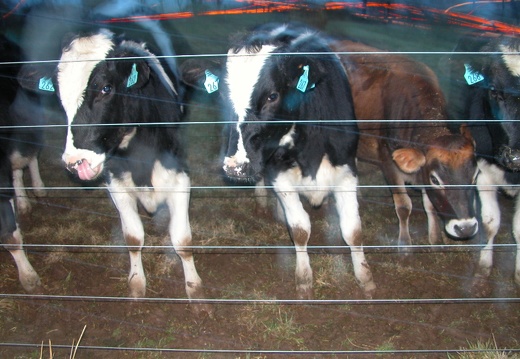
January 1, 2005: Coldstream Park, Fayette County
Coldstream Park is the largest greenspace park in Lexington's urban area. It's also a working scientific farm operated by the University of Kentucky. And also a research industrial park. Interstate 64/75 bisect the property and provides the ambient sound.Coldstream Park is the largest greenspace park in Lexington's urban area. It's also a working scientific farm operated by the University of Kentucky. And also a research industrial park. Interstate 64/75 bisect the property and provides the ambient sound. A prodigious, historic spring arises at the eastern corner of the park and flows westward. The remnants of the once-bucolic farm life, and the miniature horses, give this park a winsomely melancholic feel.
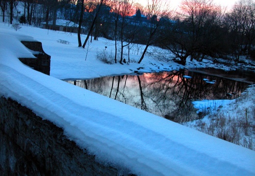
04 December 27: Cherokee Park, Louisville, KY.
Cherokee Park is Louisville's premier urban park. I visited a few days after the massive xmas-eve winter storm. The 6-inch ice-sleet-and-snow pack offered some great sledding down this park's Great Hill. Prostrating collisions occurred, but happily PixelCherokee Park is Louisville's premier urban park. I visited a few days after the massive xmas-eve winter storm. The 6-inch ice-sleet-and-snow pack offered some great sledding down this park's Great Hill. Prostrating collisions occurred, but happily Pixel and I survived erect during the long walks into the cold night.
04 December 26: Cherokee Park, Louisville, KY.
Cherokee Park is an Olmsted Park. It was so cold that night that I lost battery power for the camera. I think it was around 10-degress F. We walked much of the Bardstown Road nightlife corridor, but have no pictures to prove it.
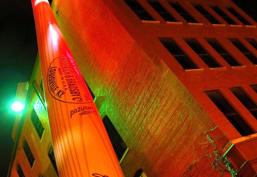
04 December 16: Louisville's Iroquois Park & Downtown Night Street Level
Louisville's Iroquois Park is one of a triad of Olmsted Parks that today anchor the city's urban core. Built over a century ago, these three parks (Shawnee west, Iroquois south, and Cherokee east) were located on Louisville's outskirts, were connected byLouisville's Iroquois Park is one of a triad of Olmsted Parks that today anchor the city's urban core. Built over a century ago, these three parks (Shawnee west, Iroquois south, and Cherokee east) were located on Louisville's outskirts, were connected by grand boulevards and planned a distinct recreational experience for each park. Iroquois Park offered the transformative summit that was in view, but fully removed from, the kinetic surge of the city. Summit Meadow hides visitors in swells of grasses and wide vistas of open sky. Perimeter trails take hikers into the 'backcountry' were crinoids and other fossils are found in abundance. A few maps are included. ENTER street level. Louisville's skyline. Intoxicating. Illuminated. In black staccato. Streets stir icy winds. Desolate of life. Monuments frozen. Bearing witness to a sullen river. Mirror to our hope. Our pretense our art.

04 December 5: Tour of Lexington's Downtown Parking Towers
While parking towers are banal objects in city life, they offer unique views of the cityscape. To access the city 'big-sky', you must ascend 50-100 foot stacks of concrete illuminated in harsh, artificial light. Of course you can drive to the top, but walWhile parking towers are banal objects in city life, they offer unique views of the cityscape. To access the city 'big-sky', you must ascend 50-100 foot stacks of concrete illuminated in harsh, artificial light. Of course you can drive to the top, but walking or biking is preferable. Pam's Ventilator, the city's tallest parking tower, is an 8-flight square coil with the best view of the city skyline. If you climb the stairs 5 times, then you've climbed over 400 feet. If you visit the elevated perches of all towers in the urban core (9 towers I consider with a total of 51 flights) then you've climbed over 500 feet and walked at least a mile. Although most towers downtown are private, their tops should be public hydroponic gardens with a tasteful neon sign that simply says, "PARK."
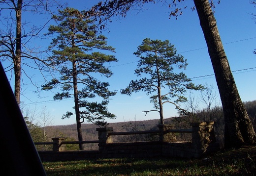
04 December 3-4: Rock Creek Loop at Big South Fork
Rock Creek Loop, a 10-mile hiking-only loop, crosses through 3 management areas; The Big South Fork, Pickett State Park, and The Daniel Boone National Forest. Rock Creek is one of Kentucky's longest trout streams and is designated a Kentucky Wild River. HRock Creek Loop, a 10-mile hiking-only loop, crosses through 3 management areas; The Big South Fork, Pickett State Park, and The Daniel Boone National Forest. Rock Creek is one of Kentucky's longest trout streams and is designated a Kentucky Wild River. Hikers also travel partly on the Sheltowee Trace and the John Muir Trail. While Rock Creek is picturesque, it presents a challenge to cross in high water. Mark Branch Falls is not on the Rock Creek Loop and is a guaranteed foot washer. I forgot my camera on this overnighter, but luckily John Thompson brought a camera and was the official trail photographer.

04 November 15: Town Branch Trail Groundbreaking
Town Branch Trail is a proposed pedestrian greenway starting in downtown Lexington and follows the historic Town Branch to Masterson Station Park. On November 15, Town Branch Trail, Inc broke ground on the Phase I of the trail. Both Phase I and II of theTown Branch Trail is a proposed pedestrian greenway starting in downtown Lexington and follows the historic Town Branch to Masterson Station Park. On November 15, Town Branch Trail, Inc broke ground on the Phase I of the trail. Both Phase I and II of the trail are funded. This initial two mile segment runs from Bracktown and the entrance of Masterson Station Park to Lewis Manor and Alexandria Drive. Masterson Station Park is Lexington's largest park, and was once pastures for Kentucky's first Methodist Church built in 1787. Rambling park offers equestrian facilities, perimeter mountain biking trail, a dog run, soccer fields, bird nesting areas and ample greenspace.
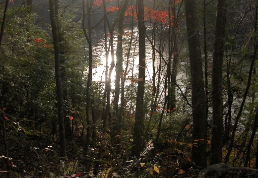
04 November 14: Bear Creek Loop, Split Bow Arch, Bear Creek OV, Big South Fork
Bear Creek Overlook is a spectacular overlook in the Big South Fork. It is not directly off the hardtop as most OVs are... so you can expect less frustration with crowds. The Bear Creek loop is a great double-track trail when dry, but not a good visit wheBear Creek Overlook is a spectacular overlook in the Big South Fork. It is not directly off the hardtop as most OVs are... so you can expect less frustration with crowds. The Bear Creek loop is a great double-track trail when dry, but not a good visit when equestrians flock there on warmer weekends, unless you like horses. If it is cold, you will have the river and 7-mile loop to yourself. You can find the USGS Bear Creek River Gauge on the loop. On the ridge, you can discover the surprising Split Bow Arch and what I guess to be a former mining headquarters.

04 November 13: Power Loop Hike in the Red River Gorge
The Power Loop Hike...need I explain more? This favorite 9.25 mile loop has 4 'ups' or creek-to-ridge ascents, which is 1800 feet of cumulative 'up' elevation change. If you finish it in 4 hours, you're walking good; in 3 hours you're marching; and in 2 hThe Power Loop Hike...need I explain more? This favorite 9.25 mile loop has 4 'ups' or creek-to-ridge ascents, which is 1800 feet of cumulative 'up' elevation change. If you finish it in 4 hours, you're walking good; in 3 hours you're marching; and in 2 hours you're smokin'. About a 1/3 of the loop is on the Sheltowee Trace. This loop is in the top 10 if not the top 5 best loops in the Daniel Boone NF.
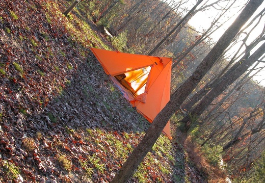
04 November 5-7: Pickett State Park, Hidden Passage, Sheltowee, Twin Arches, Hazard Cave
Many of the handsome sandstone structures you'll find in Pickett State Park were built in 1930's. Like many state parks, the Civilian Conservation Corps provided trail improvements and generally beautified the park for a growing class of weekend automobilMany of the handsome sandstone structures you'll find in Pickett State Park were built in 1930's. Like many state parks, the Civilian Conservation Corps provided trail improvements and generally beautified the park for a growing class of weekend automobile tourists. Two companies worked here. Company 447 occupied the park from 1934-1941. A memorial at the park's entrance explains, "Each company consisted of about 200 young men who were housed in tents and barracks under the management of army personnel. The men were paid $30 a month, of which $25 was sent home. They also received free housing, food, medical and dental care as well as educational benefits." The southern terminus of the Sheltowee Trace is at TN 154 in the park. It is also the trailhead for the Hidden Passage Trail. The name refers to a narrow aperture along the rim of Thompson Creek. One can find many hidden passages of death if one ventures off trail. The trail is routed above a narrow valley on a craggy gorge rim. There are many places to fall. The cliffline above Station Camp Creek near the Twin Arches is immense with towering south-facing dry rockhouses.

04 October 31: Clear Creek, Furnace Arch, Carrington Rock, Sheltowee at Cave Run
In the mid-1800's, an iron furnace operated on the banks of Clear Creek. Woodchoppers cut 35 cords of wood per day to produce charcoal for the furnace. Miners dug 12 tons of iron ore and 5 tons of limestone per day, all from the Licking River valley. TheIn the mid-1800's, an iron furnace operated on the banks of Clear Creek. Woodchoppers cut 35 cords of wood per day to produce charcoal for the furnace. Miners dug 12 tons of iron ore and 5 tons of limestone per day, all from the Licking River valley. The following text is from interpretation found at the furnace, "With a hiss of steam, air is blown into the hearth, heating the charcoal white hot. The expanding air roars and explodes out the top of the stack in a shower of sparks and flame. The furnace is in blast!"

04 October 22-24: Devil's Rapids, Blue Bend, Dog Slaughter Falls, Cumberland Falls, Moonbow Trail
The Cumberland River is one of Kentucky's scenic rivers. From high up Black mountain in Harlan County, the waters eventually flow through Cumberland Falls, then on to Nashville and into the Ohio River just upstream from Paducah. The state designates the sThe Cumberland River is one of Kentucky's scenic rivers. From high up Black mountain in Harlan County, the waters eventually flow through Cumberland Falls, then on to Nashville and into the Ohio River just upstream from Paducah. The state designates the stretch shown in these photos as a Kentucky Wild River. The hike from 208 to mile 192 (the mouth of the Laurel River) is perhaps the most scenic river hiking in the state. Mossy boulder stern river canyon, foggy morning light breaking on ridge, and moonlight twinkling on rippling water are all easily seen. What is heard is more enticing. With many shoals, rapids, and falls, the river and its tributaries offer an ambient, pleasing sound to pacify a weary backpacker. On the flip side, these can become profound water hazards. The person who named Dog Slaughter Falls undoubtedly experienced the lethal power of water. I would like to know who many people have perished in foaming cataract of Cumberland Falls. The state resort park there was established in the 1930's, and is among the 3 oldest state parks in Kentucky. The Sheltowee Trace goes straight through the visitor center and expect throngs of sightseers during pleasant weather.

04 October 17: Princess Falls, Lick Creek Falls, Kroger Arch, Sheltowee Trace, Yamacraw Bridge
Princess Falls is an appropriate name for this petite but royal fall of water. Since it is more to human scale, it invites a visitor to lounge and refresh as the stranded islanders did in Blue Lagoon. This area is definitely not tropical, but up Lick CreePrincess Falls is an appropriate name for this petite but royal fall of water. Since it is more to human scale, it invites a visitor to lounge and refresh as the stranded islanders did in Blue Lagoon. This area is definitely not tropical, but up Lick Creek is exotic. The upper valley is too rugged for horse or atvs to access, so a hiker feels more remote. Like most valleys that wind up from the Big South Fork to the ridge, you'll find a perched rim of a cliffline, snaking along at certain elevation contour with occasional passes. The narrow ridges of the Red River Gorge make it easier for us to see its cliffline, but the Big South Fork canyon hides its cliffs in deep, secret ravines.
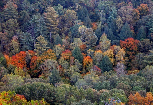
04 October 14: Pinch Em Tight and Sheltowee
One of the more popular destinations in the Red River Gorge, since the trailhead is about 10 minutes from an interstate. Foot traffic only with great views. Good for trail running since the popularity of use has created hardpacked surface trails. Tree folOne of the more popular destinations in the Red River Gorge, since the trailhead is about 10 minutes from an interstate. Foot traffic only with great views. Good for trail running since the popularity of use has created surface trails. Tree foliage is about to peak in color intensity in the valleys. Do colors change first in the valleys or on the ridges?
This area is covered in our Red River Gorge Trail Map:
[img]http://www.outragegis.com/store/images/T/th_Gorge.jpg[/img]
Buy this map
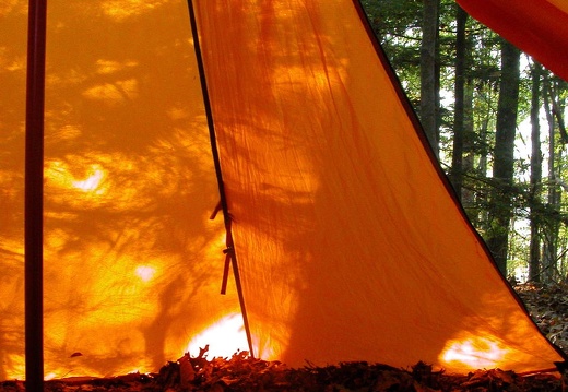
04 October 10-11: Great Meadows, Peters Mountain, John Muir OV, Rock Creek at Big South Fork
The Big South Fork is a study in the cyclical progression of a landscape. 200 hundred years ago, pioneer families came across Cumberland Gap and settled these narrow valleys. They lived in self-sufficient communities and the No Business Creek community isThe Big South Fork is a study in the cyclical progression of a landscape. 200 hundred years ago, pioneer families came across Cumberland Gap and settled these narrow valleys. They lived in self-sufficient communities and the No Business Creek community is a great example of pioneer homestead. The chimney of a long-destroyed home stands as gravestone to the community. What killed this settlement and many more like them in the Big South Fork? The industrial revolution and its need for coal and timber. Mining and logging destroyed the landscape and any chance for these communities to live as they had. The land was so fouled, that it came under federal stewardship, similar to many of our recreation lands. Today it is slowly progressing back to its pre-industrial conditions. However, you will see evidence of industry; logging pulled only profitable trees from the forest, but the then-unprofitable trees were left to stand and today you can see mature, majestic beech and hemlock trees. That alone is worth the trip.

04 October 2 to 3: Station Camp, Big Island, John Muir, Indian Dome, Bronco OV at Big South Fork
Station Camp & Big Island crossings are natural fords for the Big South Fork where islands of alluvial deposits (sand, gravel, cobble, and mussel shells) create a broad shoal. Coal is found abundantly on the islands as smooth, black cobble. Recent floStation Camp & Big Island crossings are natural fords for the Big South Fork where islands of alluvial deposits (sand, gravel, cobble, and mussel shells) create a broad shoal. Coal is found abundantly on the islands as smooth, black cobble. Recent flooding went a good 20 feet into the bank and covered the islands and its trees. Regardless of the river level, there must be a circuit in our reptilian brain that shocks us into caution when wading across a wide river. "No Business Creek" was a timbering community. Although the area is dominated by equestrian use, it is worth the trip to the river crossings. Through hikers can access the Sheltowee Trace via Laurel Ridge and the John Muir Trail via No Business Creek Trail.