Start tracking
Enable geolocation services on your device to map your location. If you have these services, locations will be sampled every second and averaged over 10 seconds. A track of your movement will be shown on the map, with estimated distance traveled. Location information will also be shown here.
No personal information is saved by this web page. You might need to check your browser and device permissions to allow this feature. If you are on trail and lose cellular signal, map tracking should still continue. Note: This feature is tuned to travel by walking or running.
Downloads
GeoTIFF of map, 222 MB (for use in Avenza Maps)
JPG of map, 2 MB
GPX of course, 40 KB
Course stats
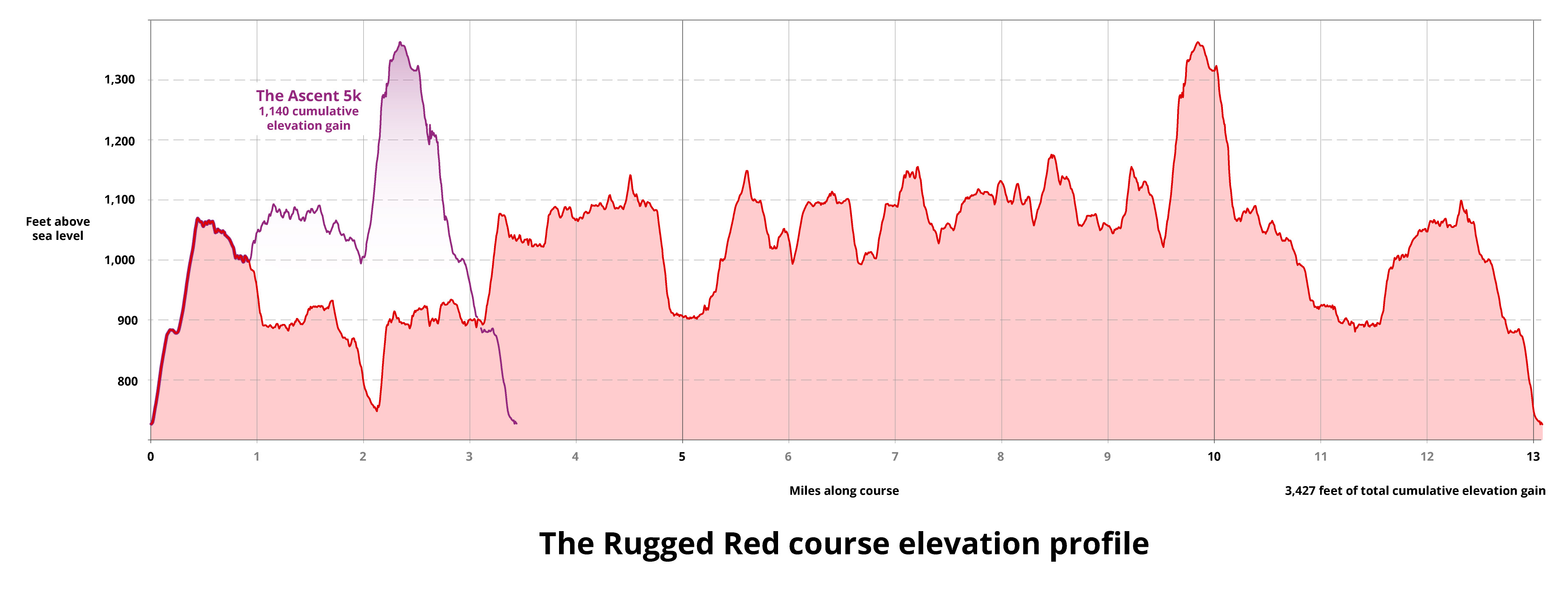
Total cumulative elevation gain is 1,140 feet. Because the course is a loop, the total loss is the same as the gain.
Elevation profile,
400 KB
When you explore the map, mile markers have info panels that can be accessed by clicking on the marker. They show cumulative elevation gain and loss for the previous mile.
Legend
Description of symbols used on map
 Point of
interest
Point of
interest
 Mile Marker
 Natural arch
 Staircase or steps
 Scenic view
 Picnic
table
Picnic
table
10ft elevation contours labeled at 100ft intervals
