


Description
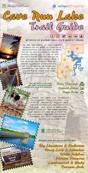 Classic Kentucky singletrack: knobby, twisty, and steep. If you are looking for a challenging and scenic trail in the backcountry, this is your map!
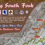
Current news, weather, and maps for Cave Run Lake
Features:
- GPS mapped trails with true-length
- 1:18,000 scale map set
- 50-foot elevation contours over aerial photography
- Full-color with GPS coordinate grid
- For long-distance hiking and mountain biking
- Trail elevation profiles and handsome overview map
Maps Include:
- 1:18,000-scale full-color maps with 50-ft contours, aerial photography, and GPS grid.
- Overview Map
- Trail difficulty map
- Trail elevation profiles
We hiked & rode over 90 miles of singletrack trail through this rugged and knobby forest to create this guide. All trail were captured with high-precision Trimble GPS. The 8-map, 1:18,000 scale, the full-color set was released on Memorial Day 2003. Official trails have elevation profiles.


Reviews
There are no reviews yet.