| HOME ACCESS SITES WELCOME | |||||||
 |
|||||||
 |
|||||||
| PAGE: 1 FILE: info.pdf SIZE: 185K DOWNLOAD LEFT+CLICK to view in browser RIGHT-CLICK to download (recommended) NOTE ABOVE MAP IS CLICKABLE |
|||||||
|
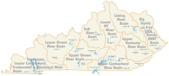
1 48 2-7 8-11 12-17 18-21 22-25 26-29 30-37 38-41 42-47 |
SECTION Basic information for using Guide Index of watersheds and basic Kentucky Map Lower Cumberland River Lower Green River Upper Green River Salt River Lower Kentucky River Upper Kentucky River Upper Cumberland River Licking River Big Sandy and Little Sandy Rivers |
||||||
|
By using any portion of this website or PDF material, you agree to this Disclaimer. |
|||||||
|
outrageGIS home
|
|||||||