
OutrageGIS mapping creates maps for process and spot color print publications and on-screen display in interactive and website uses. Our high-resolution cartographic imagery is developed from aerial photography, on-site GPS collection, digital elevation models, and existing GIS databases.
Since acquiring an offset printing press, we print all hiking and recreation maps "in-house" and "on-spec" and defines many of our design decisions. We design mostly for 2-5 spot color and for 13x18 inch sheet sizes.
|
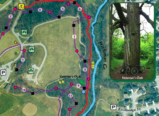
Veteran's Park Trail Map Park
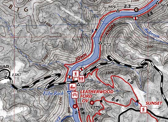
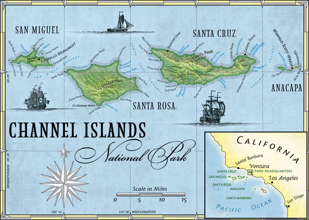
Aerial Photography Maps (8 samples) Demographic
Analysis Maps (3 samples, with links
to library)
Interactive Maps (page) Map Animations (page) GPS-Mapped Field Guides (page) Take our descriptive 2D product tour (page)
|
