Home
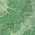
Sheltowee Trace Presentation
aan.jpg
Photo sizes
XXS - tiny
(240 x 180)
XS - extra small
(432 x 324)
S - small
(576 x 432)
M - medium
(792 x 594)
Original
(800 x 600)
slideshow
Download this file
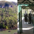
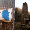
Left image is Rock Creek ford above the Big South Fork river and the right image is Rock Creek on the John Muir/Sheltowee Trace trail in the trout stream section.
Information
Created on
Wednesday 1 April 2009
Posted on
Wednesday 1 April 2009
Visits
2365
Albums
Sheltowee Trace Presentation
EXIF Metadata
Show EXIF data
Powered by
Piwigo
