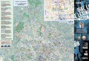
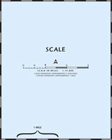
27" x 39" map at 1:19,800 scale. 1 inch to 3 furlongs. Check your local bike shop for a free, printed version of this map.
Sponsored by
Map created by outrageGIS mapping with GIS data provided by LFUCG. Infographics were courtesy of City of Madison, Wisconsin Traffic Engineering and Information Technology. Updated June, 2013.
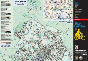
Official map, 5 megabytes (June, 2013)
Online Map, in development (July, 2013)
Map with aerial photography, 37 megabytes (July, 2012)
Book edition of map, 25 megabytes (July, 2012)
Recent Photographs & Maps

Our Favorite Hikes
If you visit this site often, you likely have a favorite map app on your phone. I certainly do and I have installed dozens of apps over the years. Most focus on placing your location as a dot on the map.
The dotAny map app that shows your location as a dot on the map fosters a dependence on your...
Our Blog
If you visit this site often, you likely have a favorite map app on your phone. I certainly do and I have installed dozens of apps over t...
We have a lot of great raster base map services available in Kentucky and I wanted to access them for my current location when I use my m...
Our Clients' Maps
If you visit this site often, you likely have a favorite map app on your phone. I certainly do and I have installed dozens of apps over the years. ...
We have a lot of great raster base map services available in Kentucky and I wanted to access them for my current location when I use my mobile devi...