Explore the mountains

A trail map and elevation profiles that would even impress Daniel Boone.
A unique set of maps and trail information for your next high mountain adventure into the first frontier.
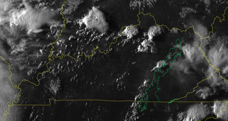
Cumberland Gap weather station
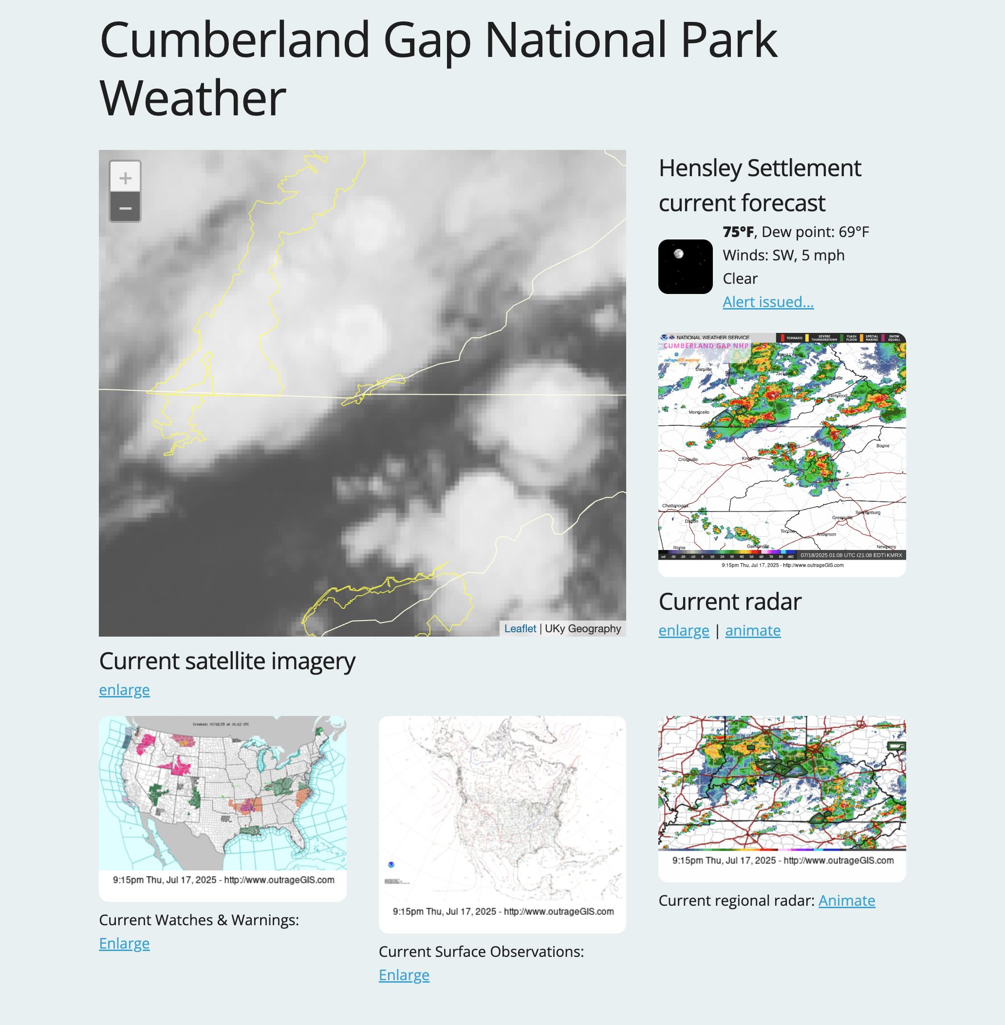
Current weather and forecasts for the Cumberland Gap area.
Bird's Eye View of Cumberland Gap
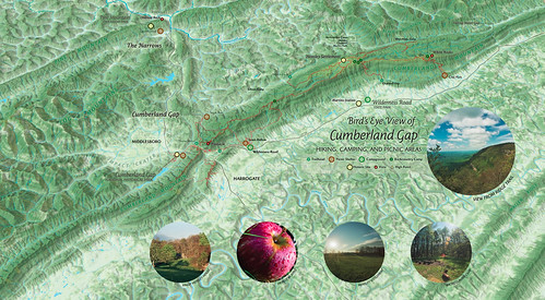
Explore Cumberland Gap with an interactive 3D map
Trails of the Park
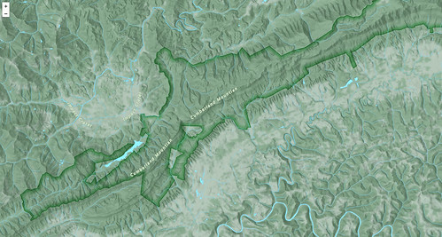
Navigate the Gap with this custom interactive map
Let's plan your adventure
This collection of maps is more than backcountry trail map.
- 1:31,640 scale GPS trail map of the park with 50-foot elevation contours and GPS grids.
two full-color, double-sided sheets at 13.5" x 19.25"
- Unique trail elevation profiles for the park that show popular loop and long-distance hikes.
- Detailed inset maps for trails around Lincoln Memorial University, Wilderness Road Campground, and Hensley Settlement.
- Map was designed for backcountry exploration and navigation. We also focused on the unique historical importance of the area, which can be found through the digital media offered on this page.
First Frontier Audio Driving Tour
We spent a year roaming the mountains interviewing folks for their oral histories, musical performances, and informative perspectives on the area's geography.
Our two-hour audio driving tour can help you plan your next Appalachian adventure.
- Listen to the first track introducing The First Frontier.
- The second track explores first impressions: Daniel Boone, as reenacted by Scott New, and the Hensley Settlement from the interpretive park ranger, Matthew Graham.
- Listen to individual tracks at firstfrontier.org.
- Download the entire tour (mp3 audio and map pdfs, 220 MB) in a single zipped file.
Music of the Gap
The song Cumberland Gap is a traditional mountain song that has been passed down and iterated over through generations.
Cumberland Gap switched hands four times during the Civil War. One version relates the tale of a soldier stranded at the Gap after the war. He bemoans how the waters can't clean his face and not a dollar could be made. His only way home was to walk.
- Listen to Rich Kirby, recorded 2003.
- Listen to Lee Sexton, recorded 2000.
For full song visit appalshop.org - Listen to Morgan Sexton, recorded 1992.
For full song visit appalshop.org
Historic readings on mountain life
Readings that give us details on mountain life in the early 20th century and also shape earlier stereotypes of mountaineers.
- The Anglo-Saxons of the Kentucky mountains, by Ellen Churchill Semple, 1910.
- Our Southern Highlanders, by Horace Kephart, 1913.
Recent Photographs & Maps