East of Salt Lake City
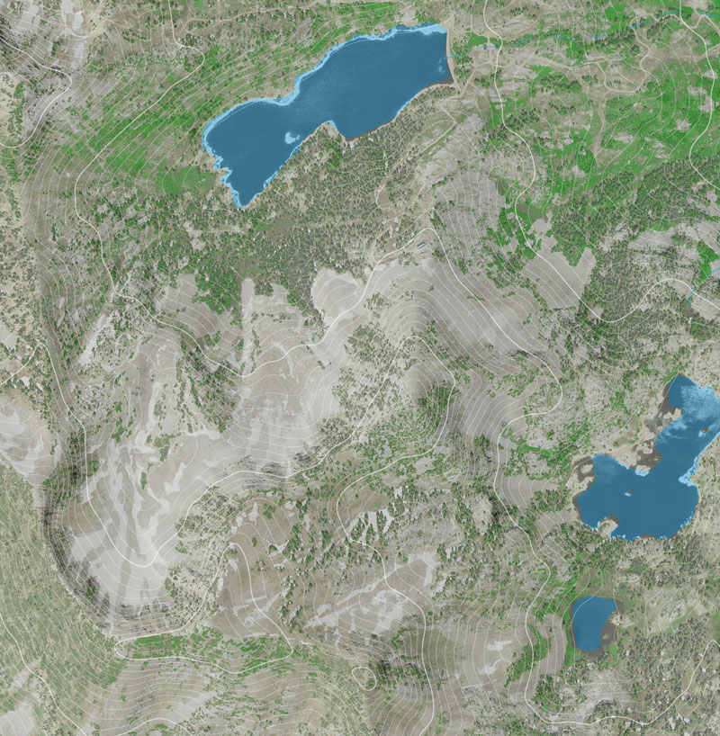
A client needed a base map for an upcoming hiking guide to areas east of Salt Lake City. We came up with a simple, clean photoshop file using NAIP aerial imagery and 1/3 arc-second seamless DEM. The NAIP was used to create an NDVI and estimated canopy cover and the DEM was used as a shaded relief and to generate 40 ft contours. The NDVI and shaded relief were used for emphasis and helped make the aerial ‘pop’ a little more. Lakes and perennial streams were added, but as you can see the don’t register perfectly with the aerial image.


Not more blue
More blue!
Very blue water!