Below are low-resolution previews of full-day animations of mountain webcams and visible satellite. They always show yesterday. Occassionally web cams will go down briefly.
Instructions: 1) After all of the images download (roughly 200k each) refresh your browser to synchronize play.
2) Click on image to get higher detail animation. Each frame is date stamped.
Look Rock: Full Resolution Animation
The camera is 2891feet in elevation in west park looking southeast
over Cades Cove and Rich Mountain
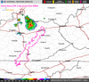
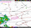
Yesterday's precipitation & temperature
24-hour records for 5 locations in national park.
Gives high & low temperatures, precipitation, and snow depth for Sugarland Center, Newfound Gap, Cades Cove, Oconaluftee, & Mt. LeConte.
STATION           ELEV   HIGH  LOW    PCPN    SNOW DEPTH     NEW SNOW
GTLT1: Sugarland Center    :  71 /  40 /  0.01 /   0.0 /    0
NFGT1: Newfound Gap, TN    :  62 /  41 /  0.00 /   0.0 /    0
TNST1: Cades Cove          :   M /   M /     M /     M /    M
MTLT1: Mount LeConte       :  54 /  30 /  0.02 /   0.0 /    0
CRKN7: Oconaluftee         :   M /   M /     M /     M /    M
Mammoth Cave NP
These weather maps show conditions in Great Smoky Mountains. Visit the park with our detailed Trail Map that shows all official trails, backcountry camps, and type of canopy cover. This is a must-have map for the physical geographer. Buy this map
From Elkmont up to Clingman's Dome and back in one day.