Welcome to the Trace
A 354-mile backcountry trail that spans the Daniel Boone National Forest and the Big South Fork National Recreation River and Recreation Area. Updated September 2020.
Trails signs of the Trace
Connecting trails are shown with mileage to help plan great section hikes and loop trips. Official trails are shown for the the Daniel Boone National Forest and Big South Fork. This map is essential for any exploration of the ST, whether it is for a thru hike or a day hike.
Current web map
We host an interactive web map that users with mobile devices and a data connection can use to locate themselves on the Trace via GPS. Our online map is keyed with our printed map, so they can work together in field. Visit sheltoweetrace.com on your mobile device.
Web map
 View an interactive online map
Our maps contain official trails in the Daniel Boone National Forest, Big South Fork NRRA, and the state resort parks at Cumberland Falls and Natural Bridge. It shows recreation areas, campgrounds, trailheads, and scenic areas. Read our blog for the Sheltowee Trace.
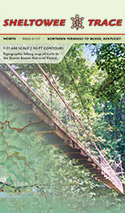
Buy this Map
Sheltowee, or Big Turtle, was Daniel Boone's name in his 1778 Shawnee family.
Topographic maps at 1:31,680 scale with 50-ft contours, trail mile markers, GPS grids, and detailed hiking info in a rich, full-color 19" x 27" page size folded down to 5" x 7". Lamination waterproofing available via our custom heat press method.
Big South Fork
Our south map now contains the official trail network for the Big South Fork National River and Recreation Area. It replaces the older John Muir Trail in the Big South Fork map.
Places to Visit
Northern Terminus - New Morehead Reroute - Eagle Lake - Rodburn Hollow - Amburgy Rocks - Four Fingers - Cave Run Lake - Clear Creek - Corner Ridge - Clifty Wilderness - Red River Gorge - Natural Bridge State Resort Park - Pendergrass-Murray Recreational Preserve - Turkey Foot - McKee - S-Tree - Horse Lick Creek - Hawk Creek - Rockcastle Narrows - Bee Rock - Cane Creek WMA - Laurel Lake - Mouth of Laurel - Cumberland River - Cumberland Falls State Resort Park - Barren Fork - Yahoo Falls Scenic Area - Big South Fork - Blue Heron - Scuttlehole - Charit Creek - Pilot Wines and Big Island - Station Camp Creek - Rock Creek - Leatherwood Ford - John Muir Trail - Twin Arches - Litton and Blevins Farms - No Business Creek - Honey Creek - Burnt Mill Bridge
Recent Photographs & Maps