 A classic weather scenario unfolded over the weekend. A strong low pressure system, located just southeast of the Great Smokies, moved along the eastern coast and left up to a foot of snow in the mountain summits to the east of the Smokies. The northeastern states received the highest snowfall totals from this storm though records were set in southern states.
Most of the snow that falls in the mountains, and especially at lower elevations, occurs during these type of storms. About 50% of snowfall at the highest elevations happens during a strong upslope flow, typically coming off the Great Lakes. These conditions bring heavy snow at the top while little at the bottom. Here mountains create weather by uplifting the atmosphere as it’s forced over the crest of the Smokies.
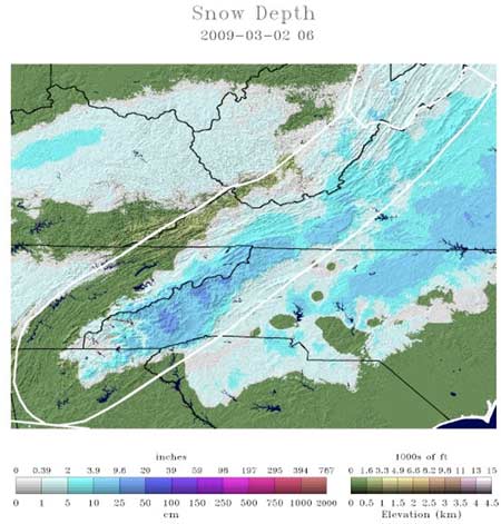
Snow depth and the darkest blues are 10″-20″ depths.
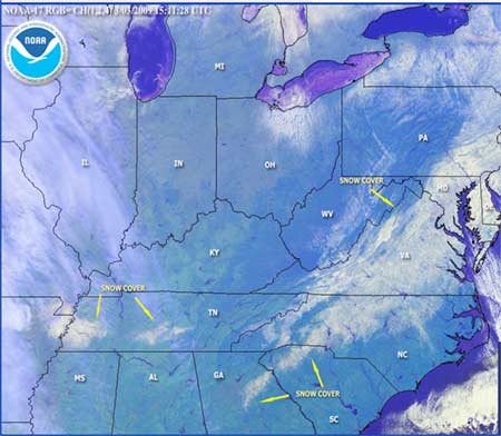
Satellite image of snow cover, from March 2
The Cold Mountain web cam had a thick layer of ice obscuring the blanket of snow left by the storm indicating a mixed bag of precipitation. The storm was accompanied by a strong high pressure located to the northwest and brought bitterly cold conditions after the low pressure moved northeast.
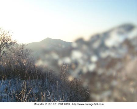
Cold Mountain web cam after some ice melted.
Mt. LeConte had 7 inches of snow and was -4° F Monday morning. Mountains to the east received 12″+ of snow. Most of the snow that fell in the Piedmont region of the Carolinas quickly melted under the March sun. The snow pack in the mountains is much colder and will survive longer especially in deep north-facing valleys.
March often sees big snowfalls in the mountains. Hikers in the highlands should plan for rapidly changing weather conditions with 20-30° F temperature ranges with wet, windy, and cold as company.
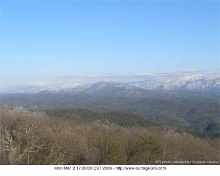
Look Rock web cam looking at Thunderhead Mt. with an obvious snow fall at higher elevations.
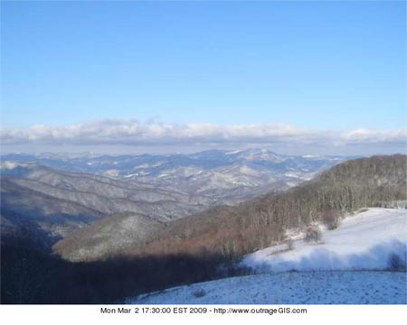
Purchase Knob web cam looking northeast over the mountains.Current weather at: http://www.outrageGIS.com/weather/grsm


