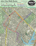
Three running routes around Chevy Chase
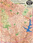
Street map for southeast Lexington with 10-foot elevation contours
Often folks wonder were to run in Lexington, especially after purchasing some fast and fly sneakers. These two maps present options for the runner. The first map locates three routes that verteran runners use for safety, scenery, and distance. The second map is simply a topographic street map for southeast Lexington inside New Circle.