
Boone Trace from James Boone Gravesite Marker to Fort Boonesboro
We’ve been working for a client developing a Boone Trace map and guide requiring maps at a few different scales. One scale is the “big picture” map and we selected a 3D basemap for this overview, letter-sized map. I spent only a few hours labeling the map, but with a little more work, I think it will look good. The color intensity might need to be reduced, if it’s decided to use the 3D map. It be more appropriate to make a simple line drawing map, in a nod to older map markers and the historic nature of the subject.
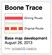
Interactive map legend
Many more hours were used to develop the driving tour basemap. Bringing in Kentucky state GIS data, the map was developed and labeled with shapefiles in TileMill. The idea is to build a good basemap for the client using online proofing and updating. After the production format and scale are chosen, we’ll create bounding boxes and clip out the print pages. TileMill styling and label placement can easily be transferred to Illustrator and with the goal of quickly designing a final proof.
Works in Firefox, Chrome, Safari, and IE8. You’ll need to run compatibility mode if your browser is IE9 or greater.


You located the original Boone Trace 1775 in Madison County, Kentucky in the wrong location that went around present day Berea and Richmond. East of Berea it followed Brushy Fork Creek partially to Blue Lick. After Fort Twitty area it crossed Pumpkin Run Creek east of Richmond through present Lake Reba City Park following Otter Creek to Boonesboro. Blue Lick is documented in April 1775 Caulk diary, 1784 Filson Kentucky map, and two deposition said “passed by the blue lick” Jessee Oldham for 1775 and Stephen Hancock for 1776. John Crook Survey of Trace 1813 referenced in Collins History. James J Shannon Jr.President Madison County Historical Society for 25 years.