Kentucky elevation profile maker

Kentucky has multiple statewide elevation layers derived from lidar point clouds. KyFromAbove Phase 1 lidar has both a 5-foot resolution ground (bare-earth) and above-ground (trees and buildings) elevation models hosted as open raster data.

We can query these layers to find ground and surface feature elevations at specific locations, such as along a line. These elevation profiles are useful in urban planning, environmental studies, and infrastructure development.

Create elevation profiles and save the data as JSON.

boydx.github.io/ky-profiles.

Below are a screenshots from the web page.
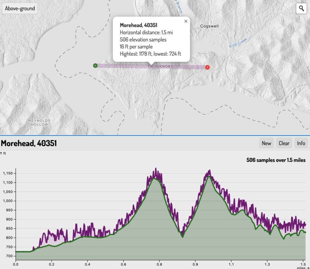
Twin Knobs show ground and trees
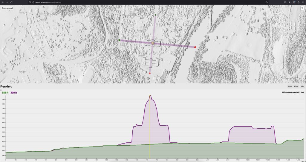
Kentucky Capitol is 209 feet tall

Kentucky elevation profile maker
Creating multiple profiles at Laurel Lake

Downloading them as JSON for use in other applications

Sheltowee Trace elevation profile

Working on the 2020 update of the Sheltowee Trace maps using high-resolution DEMs derived from lidar point clouds. An elevation profile was created by sampling elevation every 264 feet along the 343-mile trail. This profile shows the proposed extension from Burnt Mill bridge to Rugby.

Enlarge

The resolution is high enough to see the indentation of wider trail beds, which helps verify GPS data.

Trail bed observed new Gray’s Arch recreation area

The updated trail maps should be at the printer by mid-July.

0

Your Cart