First Frontier Audio Driving Tour

Download and print the two-hour audio driving tour.

What trails will you blaze through this new frontier?

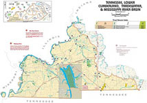
You will travel over ancient buffalo traces and Native American trails that frontier settlers cut into roads seeking the fertile lands of Kentucky. You will walk through Cumberland Gap where the Wilderness Road and the Warrior’s Path meet and look out upon America’s First Frontier. Along the Kingdom Come Scenic Parkway, you will hear the rushing headwaters of the mighty Cumberland River.

Download Hi quality (220 meg)

For adventuresome spirits, the unexplored road lures you to rugged mountain settlements and luxuriant coves of rhododendron blooms. Autumn hues of amber and scarlet sweeten your memories of fall vacations. Springtime stirs enchanting old-time songs and the colors of redbuds and dogwoods in our mountain festivals.

Website

Kentucky Boating Access Sites

Kentucky Boating Access Sites: one Texas-rigged publication!

This publicaiton was commissioned by the Kentucky Department of Fish and Wildlife and was offered freely at places throughout Kentucky where one could buy a fishing license. The 11′ x 17′ booklet is no longer printed, but you can download full resolution PDFs from this site. The publication primarily shows public boat ramps and access sites on Kentucky’s lakes and rivers. It also shows stocked trout streams and favorable waters for other species. If you’ve ever fished with a texas-rigged worm, this is your book.

Veterans Park Frisbee Golf Course

Veterans Park Frisbee Golf Coursr

Since the building of Veterans Park’s new mountain bike trails, this map is no longer completely accurate, except for the frisbee golf course. So if you like to throw the plastic disks, then you have a map here.

John’s Run Walk maps

Three running routes around Chevy Chase

Street map for southeast Lexington with 10-foot elevation contours

Often folks wonder were to run in Lexington, especially after purchasing some fast and fly sneakers. These two maps present options for the runner. The first map locates three routes that verteran runners use for safety, scenery, and distance. The second map is simply a topographic street map for southeast Lexington inside New Circle.

At Leisure’s Edge

At Leisure's Edge

Download audio documentary (66 Megabytes)

At Leisure’s Edge, an audio exploration of Kentucky’s historic black parks. This download contains maps and audio that locate and describe Kentucky’s once-segregated black parks, including Cherokee State Resort Park in western Kentucky.

Have a listen to the Introduction.

Read the Script-Radio-Documentary and visit the SoundCloud set.

Maps: InfoSheet and InfoSheet-Map

Or watch a one-hour documentary.

0

Your Cart