Interactive web maps have come a long way over the years. First we had slippy maps using raster tilesets – they’ve been around for about twenty years and are incredibly durable. However, once the tileset is rendered, it’s not easy to change the look of the raster image. You will need to render a new tileset and replace the old. Because a tileset can contain millions of images, it’s not a quick replacement.
Gaming technology evolved in the browser and brought us WebGL and vector tilesets. These tileset features have attributes and are rendered programatically in the browser. It’s rather easy to change the appearance of a feature and Mapbox built a browser application, Studio, to create endless styles of maps using vector features. What’s not easy is serving a vector tileset to a client until recently. Libraries like PMTiles bundle a vector tileset into a single file that expose the necessary to the client browser.
More recently, elevation (terrain) tilesets have made 3D maps more exciting to create and explore. Once an elevation is loaded, all other layers, tilesets, etc. are draped over elevation surface. Depending on the resolution of the elevation data, this surface can dramatically change the appearance of the map.
Using an open source mapping library like MapLibre GL JS, a browser can simultaneous consume raster, vector, and terrain tilesets to make a 3D map for any place you have data. Kentucky has excellent data availabilty including lidar data to make high-resolution elevation surfaces. This map uses that lidar data to create the terrain tileset and a shaded relief raster tileset. The vector tilesets for trails, roads, etc. are derived exclusively from OpenStreetMap. The water layers are from the USGS National Hydrological Dataset.
Below is a screen capture of the web page and a link. You might notice that it doesn’t have all of the trails that our printed maps show. We may add those trails in the future, because it would helpful for planning your trip. And, we’re not planning to move to an exclusive mobile app. With all of the advances in mobile technology, we think paper maps are still essential for learning basic navigation and map reading.
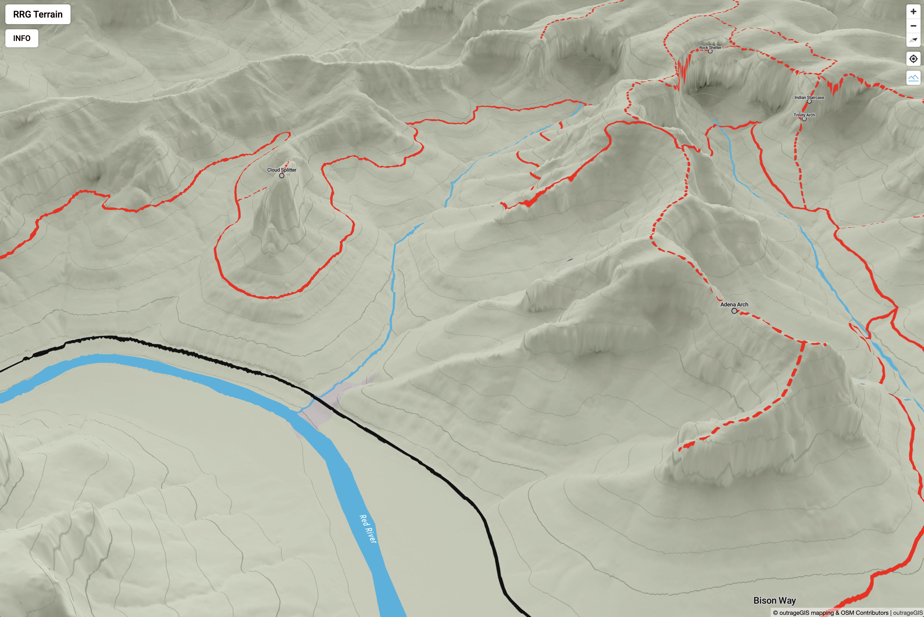
The map can be loaded here: outrageGIS.com/gorge/map
Happy adventures!


Speak Your Mind
You must be logged in to post a comment.