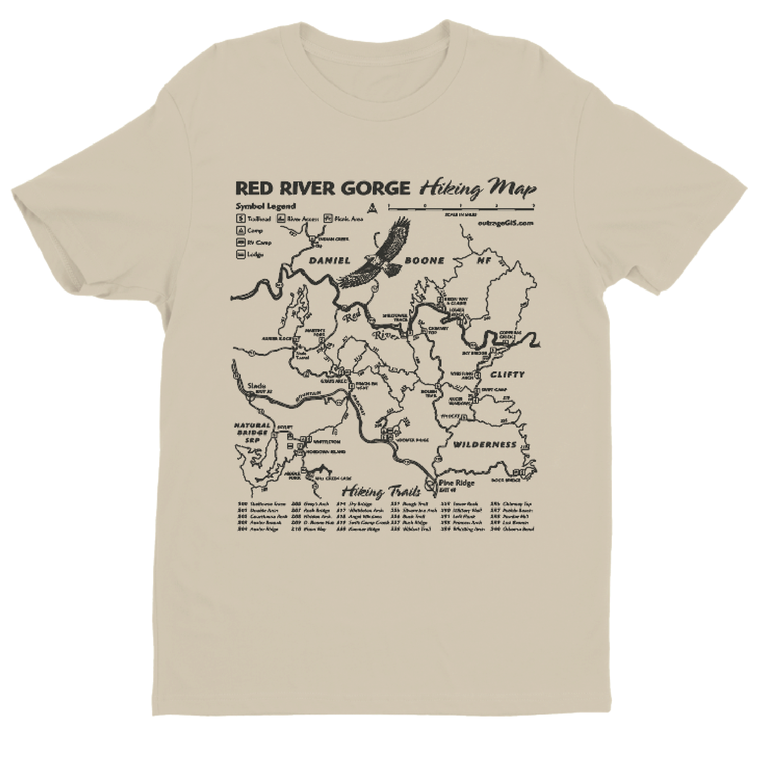
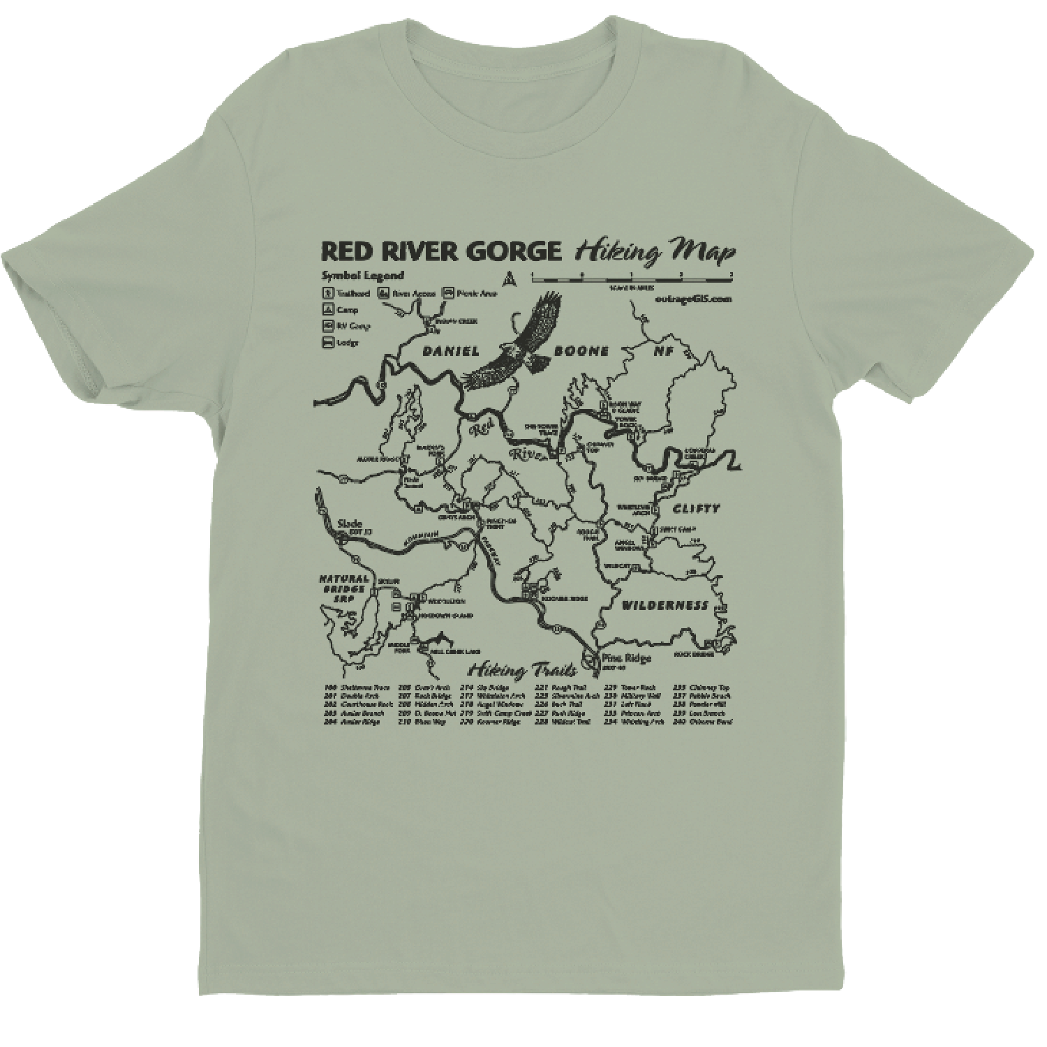
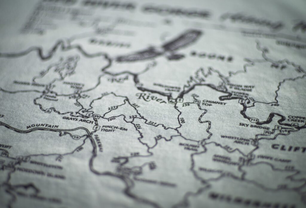
30 of the most legendary trails mapped across your chest.
Our Red River Gorge Trail Tee is the ultimate conversation starter and functional wearable. We brought it back by popular demand so you can now get the shirt that fellow hikers have literally tried to buy right off our backs.
This is the perfect gift for adventurers, climbers, or anyone who’s tried to explain why you’d drive for hours just to walk in the woods. Currently available in very limited quantities!
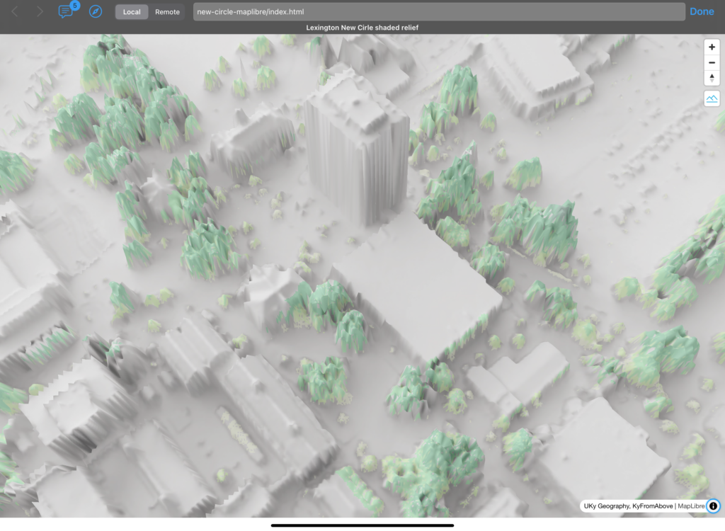
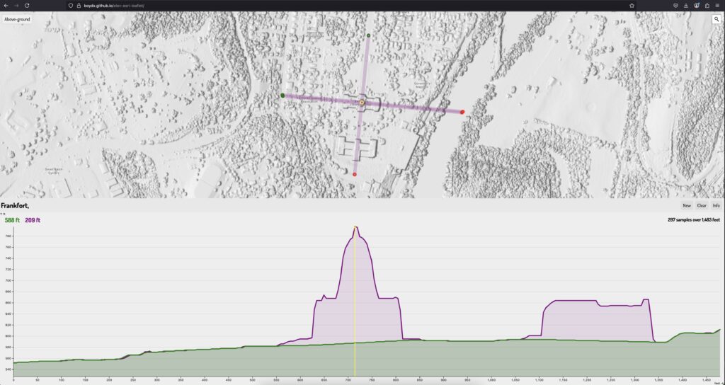
 Oblique of Frankfort
 Viewer interface
 Viewer interface
 Viewer interface
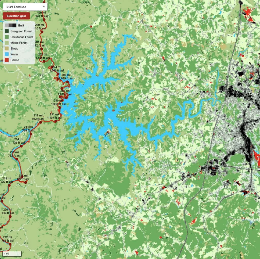
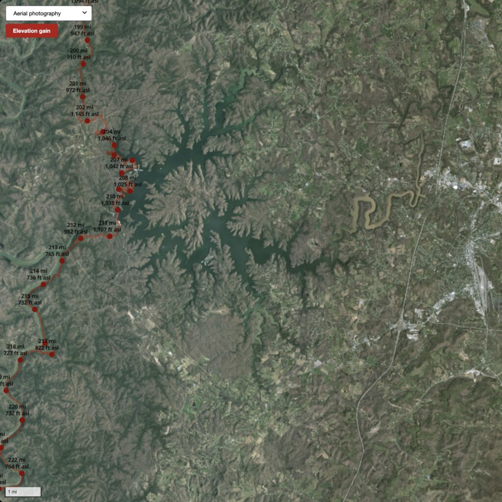
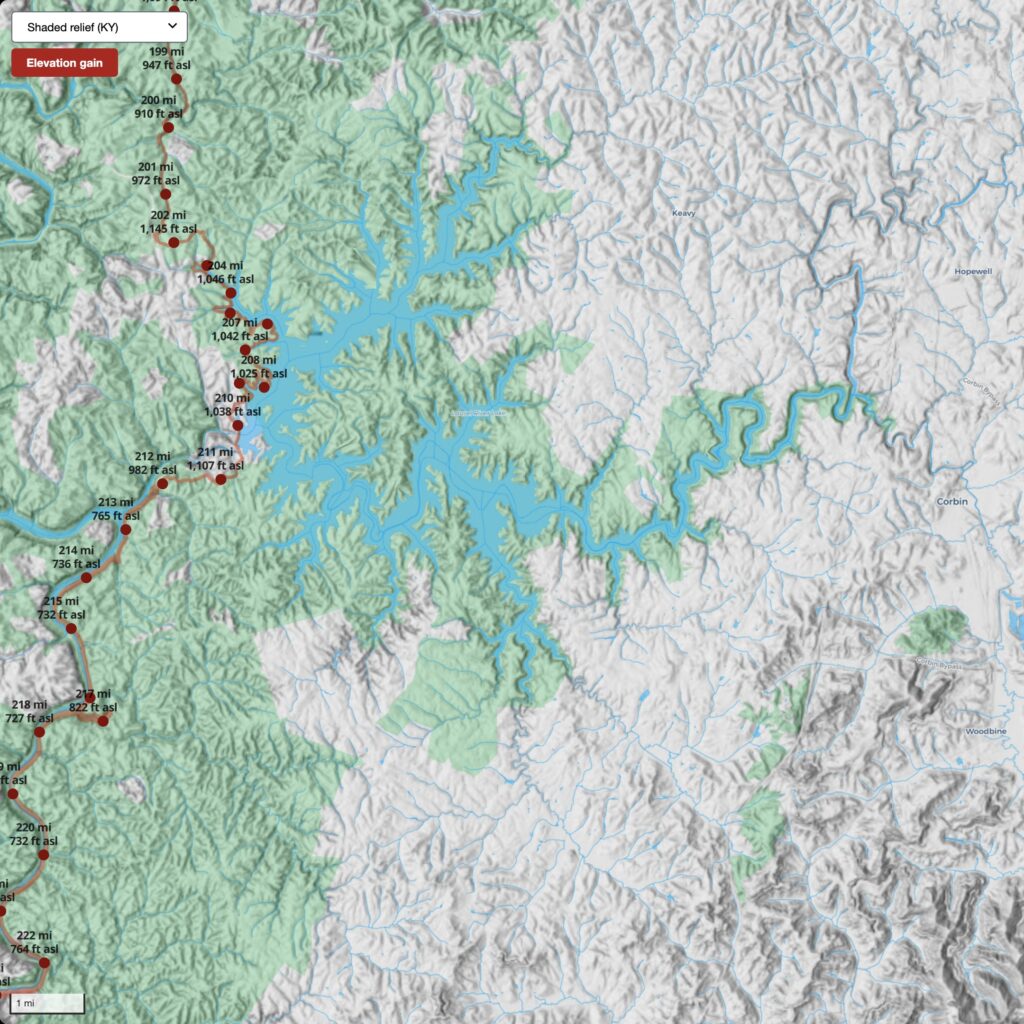
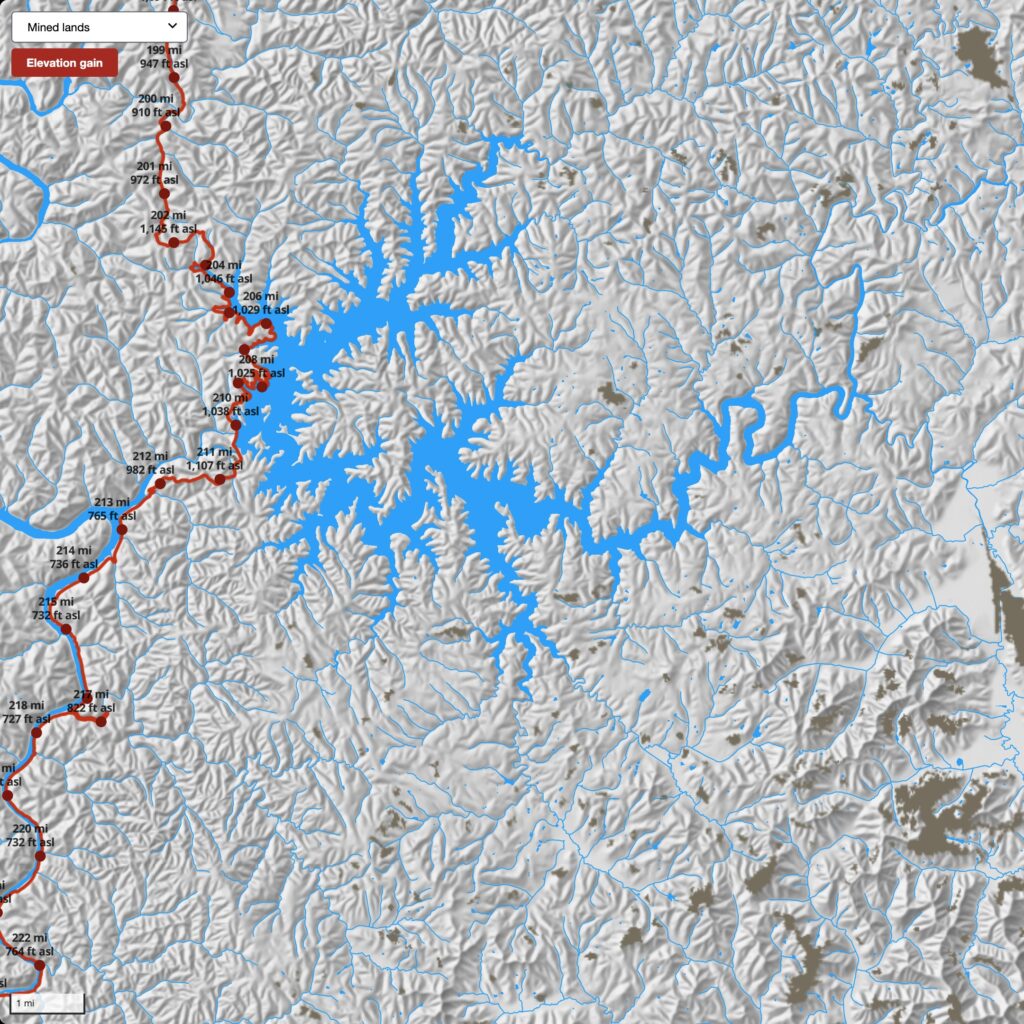
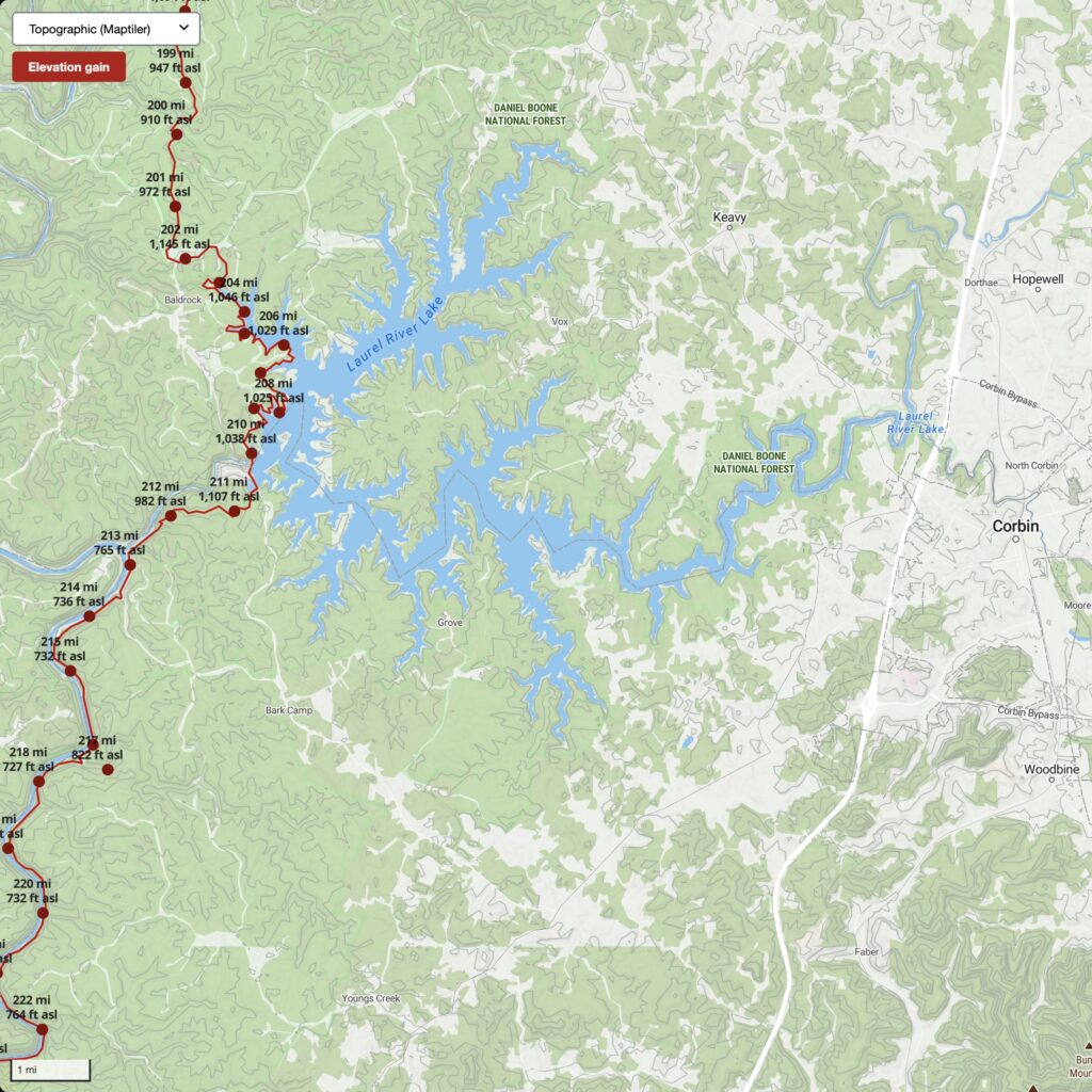
 Oblique of Laurel Lake
 Search by flight and shot ID
 Attributes of image footprint centroid
 Phase 1 decrease in height
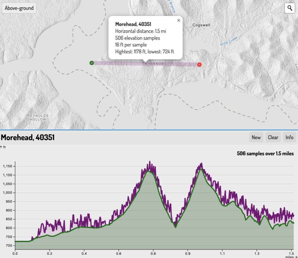
 Phase 2 increase in height
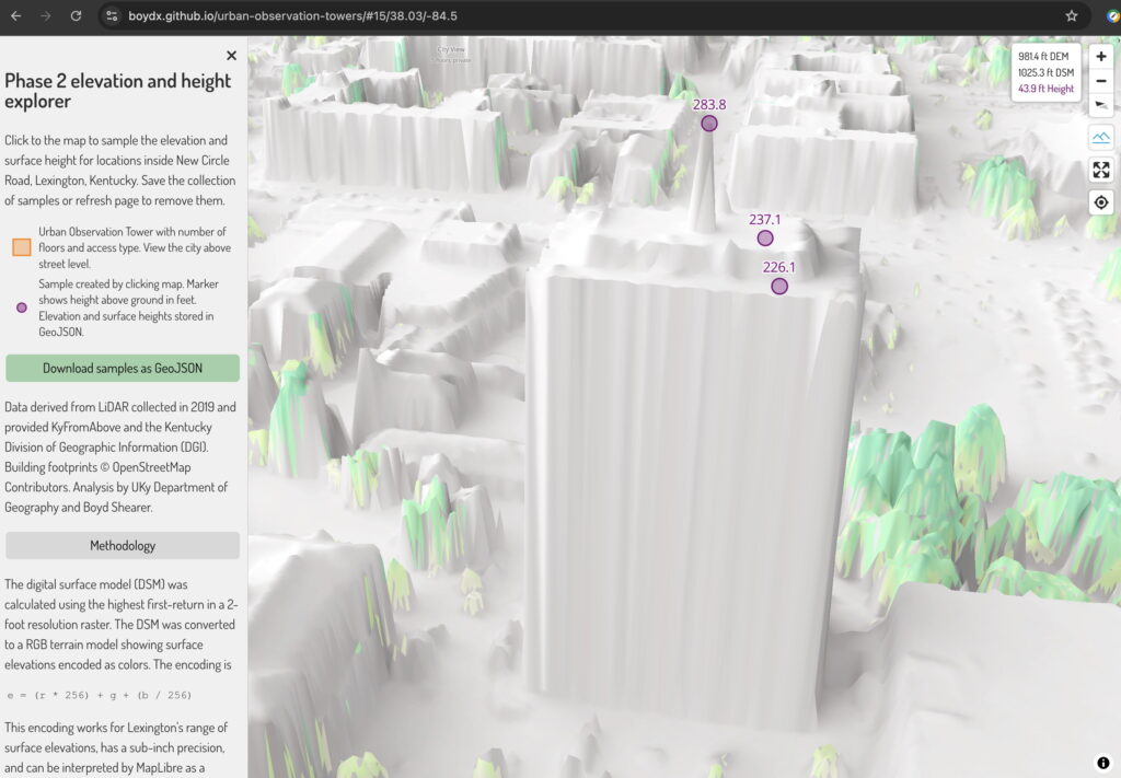
 Phases combined
 Phase 2 colorized with aerial photography


 KyFromAbove Data Explorer