Description
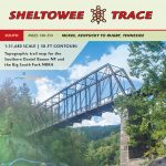
2020 update. We’ve updated the map and is included in the Sheltowee Trace South Trail Map (includes Big South Fork)
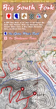
Guide for the John Muir Trail and southern Sheltowee Trace, the two best 3-night foot trails in the Big South Fork. This guide is the most detailed map set for the John Muir Trail and connecting scenic trails. We detail 25 unique trips ranging in length from a few hours to the rugged 45-mile JMT. Discover a new Big South Fork.
Features:
- GPS mapped trails with mileages
- 6 multi-color maps & elevation profile
- 50-foot elevation contours over aerial photography
- UTM & GEO GPS coordinate grid
- For long-distance hiking and mountain biking
- Carries in a 4-mil zipper poly bag for durable use
Maps include:
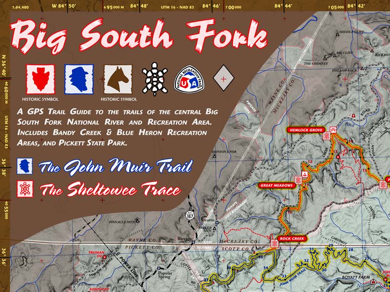
- 1:84,480 scale Overview Map. 6-color, 18.5 x 13.5 inches. Shows all trails between O&W Bridge and Blue Heron with mile markers for the John Muir Trail and Pickett State Park.
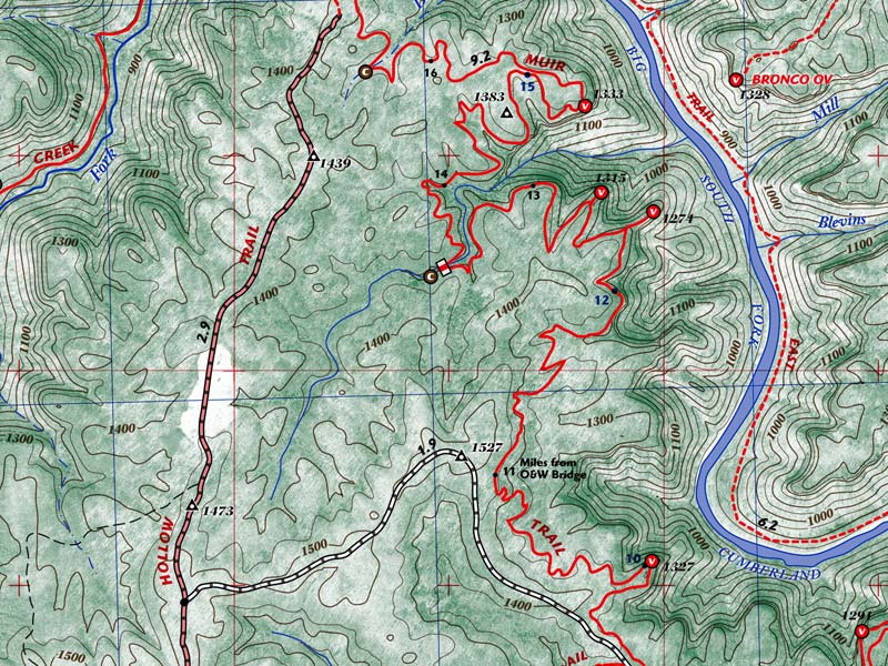
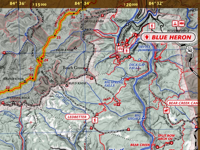
- 1:31,640 scale Topographic Maps. 5-color, 18.5 x 13.5 inches. 2 Pages. Shows true mileage between intersections for all official trails. 50-ft elevation contours. Shows the entire John Muir Trail and all intersecting trails.
- 1:18,000 scale Inset Maps of Bandy Creek, Blue Heron, and Pickett State Park. 2-color, 18.5 x 13.5 inches.
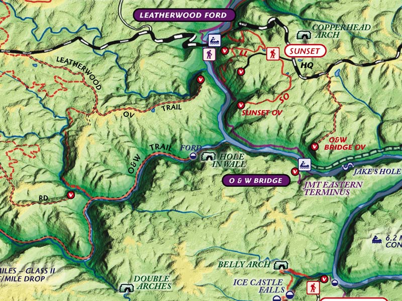
- Unique 3D Map of Big South Fork that shows all trails and unique geologic and scenic places. Full-color, 18.5 x 13.5 inches.
- Trail Elevation Profile for the John Muir Trail with information about the new trail signage system.
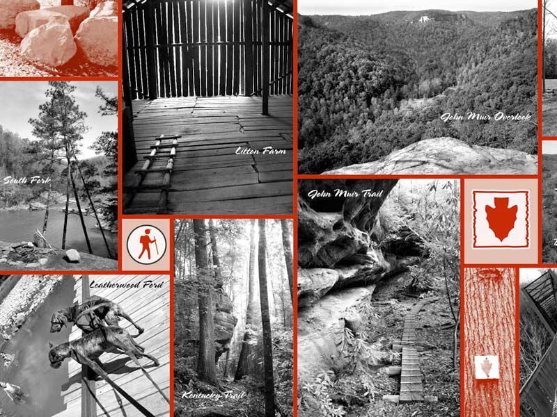
Backcountry trails include the 45-mile John Muir Trail, the 45-mile southern terminus section of the Sheltowee Trace to US 27, the Kentucky Trail, Twin Arches Loop, Litton & Blevins Farm Loops, Pilot Wines & Big Island Equestrian Loops, Hidden Passage Loop, Rock Creek Loop, Leatherwood Ford Loop, Grand Gap Loop, Blue Heron Loop and trails around the Charit Creek Lodge area. Over 200 miles of trails mapped!
Scenic areas include Angel Falls Overlook, Sunset Overlook, O&W Bridge, Bronco Overlook, John Muir Overlook, Fall Branch, and No Business Creek.


Reviews
There are no reviews yet.