Locate yourself on the ST
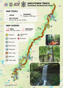
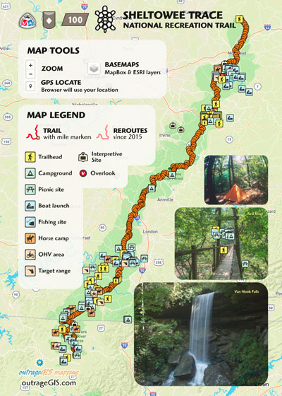
We’ve updated our map of the Sheltowee Trace on our ST site:Â sheltoweetrace.com/hike. The map has symbols for official recreation sites and trails for the Daniel Boone National Forest, Big South Fork National River and Recreation Area, and Cumberland Falls and Natural Bridge State Resort Parks. Of course, it has the ST and mile markers from the northern terminus.
Since we deployed this map last year, we have updated the Leaflet and MapBox JS to make the work with a GPS-enabled device as long as you have a cellular data connection. The points of interests and trails are clickable with useful travel information.
Our next goal is to fill out the map with more scenic destinations and include more photographs. Let us know if you have any suggestions.


Is there a setting to hide pictures? I want to see the topo lines – not joe random’s dog. There are too many pics cluttering the map and it lessons it’s functional value. Thanks.
Is there GPS data that can be downloaded into a Garmin GPS without having to have a cellular connection?
Places to get water for people hiking long sections would be awesome. As well as maybe potential camping sites.