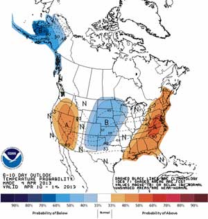
6-10 day temperature prediction
We know this weekend is setting up to be the best hiking weather we’ve had in this year. So go out if you can! But if you can’t and would like to plan a trip next weekend, it’s also looking good. This climate model predicts we’ll have higher than normal temperatures and precipitation during next weekend and into the first of week following. Temperatures could average around 55° F with rain about 0.4″ above normal rates for April 10-14. That’s a good spring forecast and we welcome the coming of the growing season.
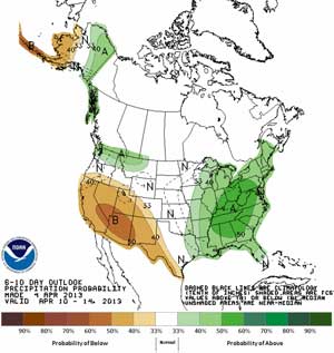
6-10 day precipitation forecast

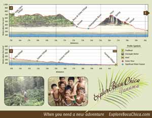


 Red River Gorge Backpacking Map


