Description
Cumberland Gap cover wrap
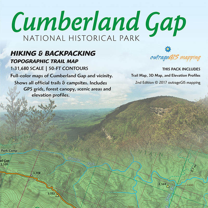
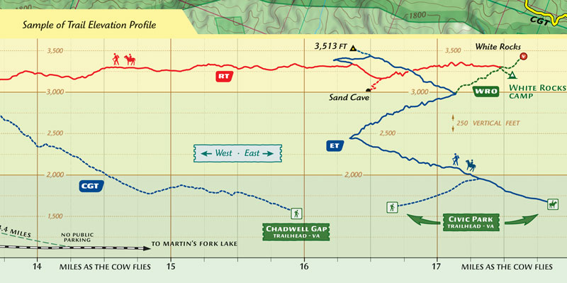
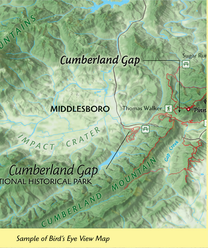
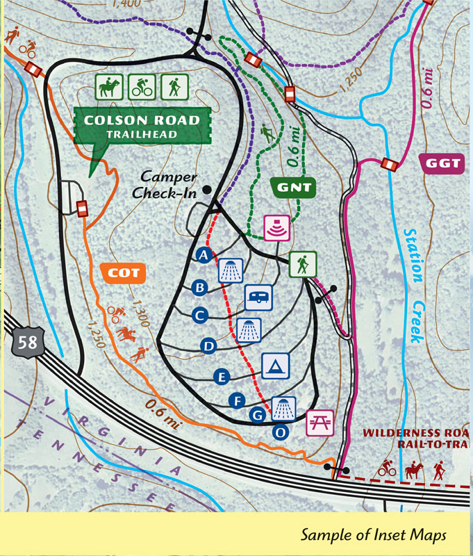
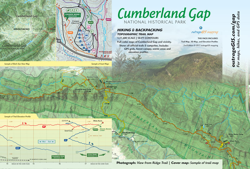
Get the most detailed topographic hiking map for the Cumberland Gap. Our map features innovative trail elevation profiles and detailed insets, including the historic Hensley Settlement and the historic Gap. It’s the ultimate guide for exploring over 80 miles of trails and the park’s dramatic 2,000 feet of vertical relief. Explore assured, you’ll own the best backcountry trail map available for the Cumberland Gap NHP.
Features
- Two double-sided full-color 13.5″ x 19.25″ sheets
- GPS-mapped trails and backcountry campsites
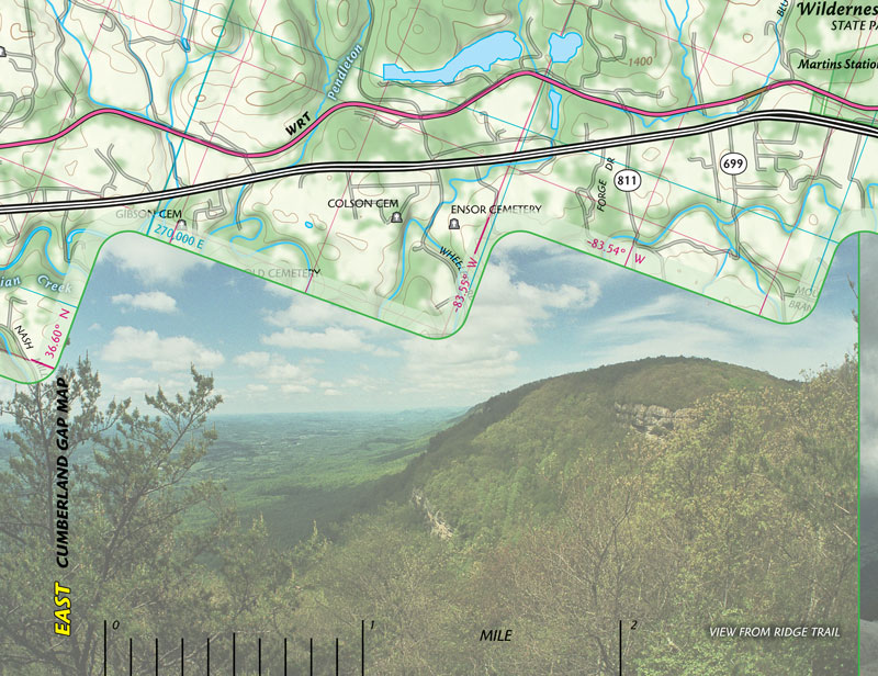
- 1:31,640 scale map of the entire park with four 1:12,000 scale inset maps
- 50-foot elevation contours and aerial photography
- Canopy cover and terrain relief are shown with a GPS coordinate grid
- Includes Lincoln Memorial University mountain biking trails
- Carries in a 4-mil zipper poly bag for rugged use
Custom Lamination Process
Get maps that last. Our premium, laminated maps are made with a custom heat press for superior durability, guaranteeing they fold flat and stand up to any adventure.
Trail Photos from Cumberland Gap
Check out our photos from the trails.


Reviews
There are no reviews yet.