Phase 2 elevation and height explorer

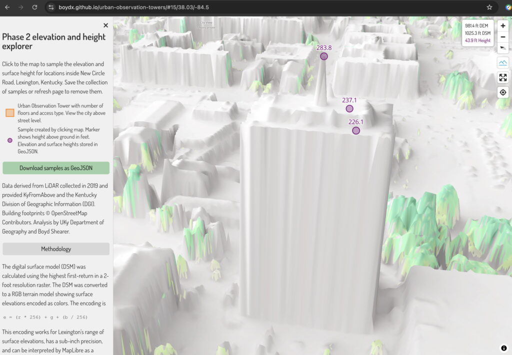
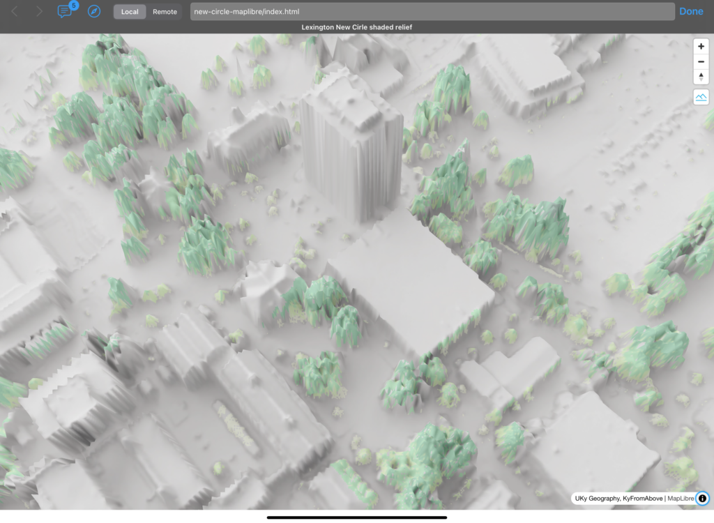
Building on our elevation profile maker, we examined height and elevation measures generated in the browser from Phase 2 elevation data within Lexington’s New Circle Road area.

Given the absence of a statewide digital surface model (DSM) for Phase 2, we created a self-hosted raster tileset. This approach encodes elevations as RGB JPEGs or PNGs, which can be natively read by browsers.

The DSM was calculated from the Phase 2 point cloud using the highest first-return in a 2-foot resolution raster. The DSM was converted to an RGB terrain. The following formula converts the three-band values to elevations:

e = (r * 256) + g + (b / 256)

Pretty simple! This encoding works for Lexington’s range of surface elevations, has a sub-inch precision, and can be interpreted by MapLibre as a ground surface on which to drape features. A shaded relief map of the DSM with tree canopy cover height is the default base map. In terrain mode, the map becomes a 3D surface showing relative heights of features.

Height is calculated by subtracting the digital elevation model (DEM) elevation from the DSM surface elevation. The DEM is a 2-foot resolution raster that models bare-earth ground elevation and is hosted on kyraster.ky.gov.

Explore the web page here: https://boydx.github.io/urban-observation-towers

Click the map to sample heights and elevations. Export the samples as a GeoJSON for use in another application.

Screenshot from the web page
Enlarge screenshot from the web page

Screenshot from the web page
Enlarge screenshot from the web page

Screenshot from the web page
Enlarge screenshot from the web page

Elevation explorer looking at the height of Patterson Office Tower
The three heights of Patterson Office Tower

Data derived from LiDAR collected in 2019 and provided KyFromAbove and the Kentucky Division of Geographic Information (DGI). Building footprints © OpenStreetMap Contributors. Analysis by UKy Department of Geography and Boyd Shearer.

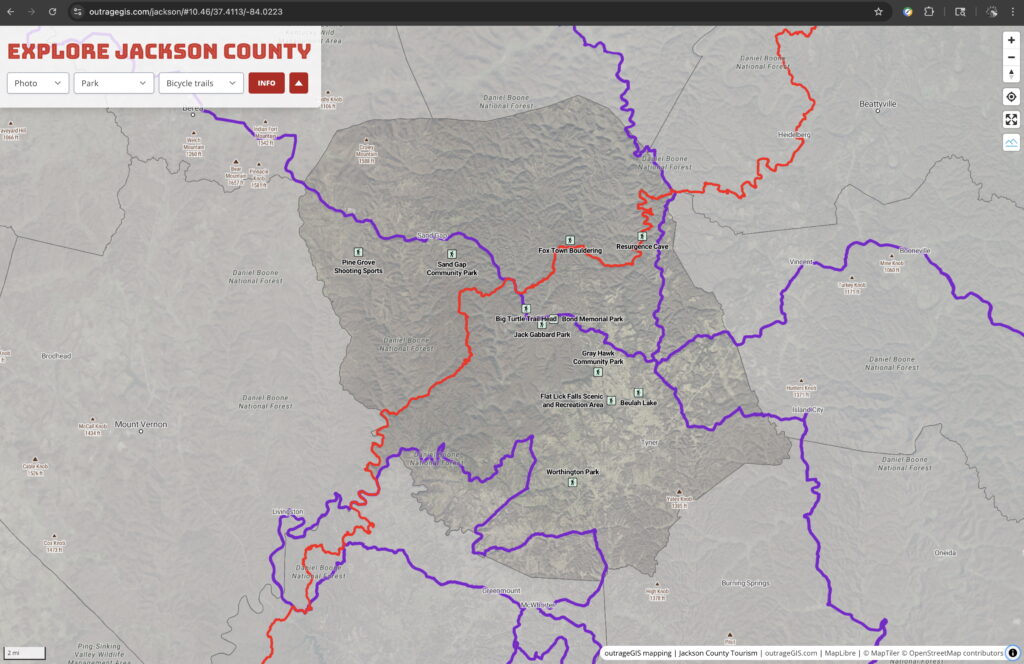
Explore Jackson County

Using the latest KyFromAbove 3-inch resolution aerial photography from 2024, we can get comfortably lost on our backcountry adventures. The latest imagery from our state’s aerial mapping program is impressive and in line with previous releases: it’s comprehensive, authoritative, highly detailed, and open data. We have updated two projects with the latest base maps from KyFromAbove.

Screenshot of web map
Explore Jackson County web map
Screenshot of web map
Explore Jackson County web map
Screenshot of web map
Explore Rowan County web map
Screenshot of web map
Explore Rowan County web map

Kentucky elevation profile maker

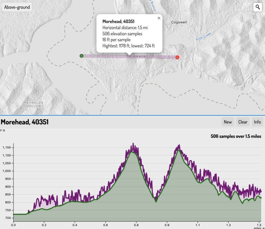
Kentucky has multiple statewide elevation layers derived from lidar point clouds. KyFromAbove Phase 1 lidar has both a 5-foot resolution ground (bare-earth) and above-ground (trees and buildings) elevation models hosted as open raster data.

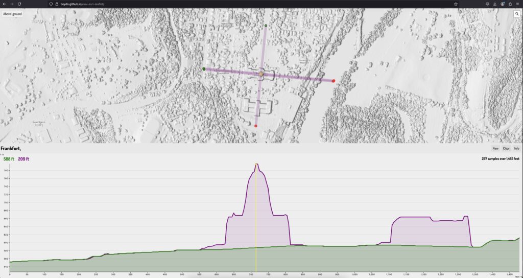
We can query these layers to find ground and surface feature elevations at specific locations, such as along a line. These elevation profiles are useful in urban planning, environmental studies, and infrastructure development.

Create elevation profiles and save the data as JSON.

boydx.github.io/ky-profiles.

Below are a screenshots from the web page.

Twin Knobs show ground and trees
Kentucky Capitol is 209 feet tall

Kentucky elevation profile maker
Creating multiple profiles at Laurel Lake

Downloading them as JSON for use in other applications

Shaded relief and 3D visualization in the browser

KyFromAbove has long produced elevation datasets for the public. Using their Phase II lidar point clouds, we created a new shaded relief and DEM raster tile sets for web mapping. While most mapping applications focus on ground elevations, we use the above-ground elevations to make a digital surface model (DSM). These elevations show buildings, trees, and even cars.

These above-ground elevations, however, have unique challenges. The latest project attempts to minimize errors and create visually impactful shaded relief and RGB terrain layers from DEMs for elevations.

Check out the preview here: outrageGIS.com/maps/new-circle

Screenshot map web page

Lexington’s UKy campus

0

Your Cart