
 Red River Gorge Backpacking Map
Distance: 1.5 Miles loop trail
Difficulty: ++
Scenic Views: +++
Elevation Relief: 400ft ^
Ownership: Daniel Boone National Forest, USFS
| Red River Gorge Backpacking Map: $14 |
 |
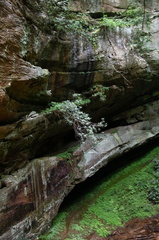 A hike from Gray’s Arch Trailhead to D. Boone Hut and Martin Fork. A large area of ferns can be found on near the crossing of Martin Fork and scenic overlooks offer limited views down the valley and across the valley to Tunnel Ridge Road.


Speak Your Mind
You must be logged in to post a comment.