On July 4th we released a trail lover’s and backpacker’s atlas for a wild & historic national treasure, the Great Smoky Mountains National Park. Our trail atlas was designed for the modern trail user equipped with a GPS, but we focus our cartography on showing the rugged, historical, and ecological character of the park. These maps are beautiful, easy to read, and provide a pleasure as you wander over the pages and discover a new Smokies.
The Boone Trace Magazine
We are proud to have contributed to the recent Daniel Boone National Forest magazine, The Boone Trace. This comely tabloid-sized full-color magazine is the U.S. Forest Service’s official visitors’ guide and welcome publication with maps, photographs, and timely information. With over 700,000 acres, 100+ developed recreation sites, and 600+ miles of trail, this national forest provides ample opportunities to refresh, reconnect and challenge yourself in the great outdoors. The Boone’s Trace magazine is free and should be the first document you read before your adventure in the forest.
The opening paragraph reads, “Dense woodlands, towering cliffs and plunging waterfalls are just a few of the natural wonders found within the boundaries of this most unique forest. Extending across mostly rugged terrain, the forest provides breathtaking scenery, clean water, and an abundance of wood and wildlife.”
The national forest is now divided into four ranger districts; Cumberland, London, Redbird, and Stearns Ranger Districts. The Cumberland Ranger Districts has two of the most popular destinations in the forest, Cave Run Lake and the Red River Gorge. This knobby and cliff-rimmed country is home to historic iron furnaces, rare and endangered plant communities, great arches and sandstone formations, and the rugged Cliffty Wilderness Area.
The London Ranger District is defined by the Rockcastle and Laurel Rivers. Great recreation destinations include Bee Rock, Rockcastle Recreation Area, Turkeyfoot, S-Tree, and the Laurel River Lake. While forest ownership less continuous in this district, many trails (official and unofficial) spline the ridges and creeks for hikers, mountain bikers, and motorized vehicles.
The Stearns Ranger District is home to the Beaver Creek Wilderness Area, Natural Arch Scenic Area, and numerous horse camps, shooting ranges and picnic areas. The area outlines the northern portion of the Big South Fork Recreation Area, which competes with the Red River Gorge for the title, “The Land of Many Arches.” The Redbird Ranger District is not contiguous with the other ranger districts, but off-road vehicle and mountain biking enthusiasts will find the Redbird Crest Trail a fine loop trail.
The Sheltowee Trace is forest’s unifying, long-distance trail, which connects the northern tip of forest with Tennessee’s Pickett State Park. This is the forest’s only National Recreation Trail and is the longest trail in Kentucky. Trail users can find more information at http://www.sheltoweetrace.com.
Magazine designed by Gwen Hensley of the forest service.
At Leisures Edge: Maps in Video
During the early days of outrageGIS mapping, Boyd finished a one-hour video that explored once-segregated black parks in Kentucky. The historic parks found in the movie are Douglass Park in Lexington, Iroquois & Chickasaw Parks in Louisville, Stuart Nelson and Noble Parks in Paducah, and Cherokee State Resort Park in Aurora.
Scales, grids, and graticules
Measurement scales, grids, and graticules for our printed map titles. Print them at home and use them in the woods to more precisely locate yourself with a GPS unit set to DD MM.MMM, on a UTM grid, or just measure linear distance.
These handy print outs have other information about the map they cover and fit in the polyzip carry bag.
Remember, don’t rescale these pdfs when you print them.
To download scales, visit: outrageGIS.com/scales
New Maps Released
Over the past few months we’ve created some maps that are related to outdoor recreation and trails. While not guides for public recreation areas, they represent smaller cartography projects we like to do. The maps use GPS-captured data, aerial photography, and a slight 3D rendering technique to give the maps a unique and intuitive representation of the geography.
The image on the left is a screen-capture of the Town Branch Trail Plan. The trail is a proposed greenway that connects downtown Lexington, Kentucky with distant Masterson Station Park, one of the city’s largest park. The aerial photography is derived from high-resolution, 2ft-pixel imagery, and is accentuated by a subtle 3D relief. Lexington spreads over a large anticline, a geological feature characterized by a broad uplift of land, and causes the situation that most streams flow away from the center of the city. Elevation relief in the downtown area is slight, but increases dramatically as one approaches the Kentucky River to west and south. Future plans for the map are adding more interactive features, such as pop-up info boxes.
The map to the right is part of 3-part map project for Red River Gorge Cabin Rentals, an exclusive resort area in the Red River Gorge. The maps were a 2D, 3D, and Google map showing cabins, trails, and roads. We GPS-captured roads and trails and created a simple shaded relief map for generic directions, and a more artistic 3D aerial photographic map of the resort.
Here is a quote from their website, “Located in the heart of the Daniel Boone National Forest in Kentucky lies a paradise of natural stone arches, caves, rock shelters and towering cliffs all encircling steep, forested slopes overlooking narrow stream valleys.” You can visit thier website here.
Waypoints in the Great Smoky Mountains
Great Smoky Mountains GPS Data Pack
Waypoints & track GPX data for trails, trail intersections, backcountry camps, summits, gaps, and many other locations for backcountry navigation.
Download: 36 megabyte
Format: GPX & PDF
Pieces: Map Guide, GPS Manual, Gazetteer, Data
Ownership: Great Smoky Mountains National Park, NPS
Great Smoky Mountains GPS Data Pack: $6 |
![]() |
Our data pack contains 16 GPX files, companion gazetteer, and historic topographic map with 1-minute GPS grid. The product is offered only as a 36 megabyte download, which includes all documentation, maps, and data. Buyers have free access to new releases and updates.
[Read more…]
Cumberland Gap Trip Planner
Great Backcountry Trips at Cumberland Gap
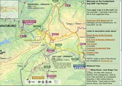
This webpage with zoomable map shows awesome backcountry trips in color-coded loops, all of which use some segment of the Ridge Trail. Trips are organized as weekend excursions with suggested camping and water access. The map is a simplified version of the full topographic trail guide found here. The full map also contains the useful elevation profiles for trails.
The page also has links to audio about recreation in Cumberland Gap. The audio is part of the free audio driving tour we produced entitled, The First Frontier Audio Driving Tour. The entire tour can be download for free at firstfrontier.org.
Cumberland Gap Trail Guide
Ownership: Cumberland Gap National Historical Park, NPS
Google to trailheads
Cumberland Gap Trail Map: $12 |
![]() |
Visit the Cumberland Gap trail planner for your next backcountry trip.
Great Smoky Mountains Weather Station
We introduce our new weather page for the Great Smoky Mountains National Park.
This site aggregates the best weather data and maps for the national park and surrounding mountain area. Maps are from the National Weather Service (NWS) and composited with the national park boundary for easy location. The data is fed from real-time NWS observations and watches, warnings, & advisories.
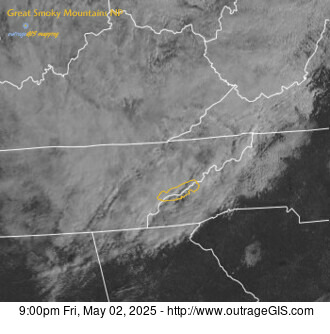
We think this is the best page for your weather needs if you plan to visit the smokies or long to be there now. For example, the map at left shows the visible satellite of the region centered on the park, shown in the yellow polygon. Cloud cover is good to consider for photographic trips. If the map is dark, well…you’ll need a flash or long exposure.
Other weather information and tidbits we include are links to the official NWS forecast page, which is an excellent site, and webcams for Look Rock and Purchase Knob. We have a link to the high & low temperatures, precipitation, and snow depth for the Sugarland Center, Newfound Gap, Cades Cove, Oconaluftee, & Mt. LeConte.
You can visit the page here: http://www.outrageGIS.com/weather/grsm. We also constructed a page that has current radar, visible satellite, and weather statements here.
NACIS Conference 2007
Lunch-time excursions to Forest Park. That’s how I spent my free time at the North American Cartographic Information Society conference in St. Louis. While it was exciting to see new maps and presentations about cartographic history and even making maps, I had to visit a prominent swath of green on my St. Louis Map.
Enter Forest Park; an urban park established after the Civil War and used as the site for the 1904 World’s Fair. Today you can freely walk along a sculpted archipelago of scenic lakes & historic monuments, freely visit an art museum and fantastically intimate zoo. I wish my city had a Forest Park.
Some photos: http://www.outragegis.com/pixel/071009_14-ForestParkMO
note: these photos were shot with a camera phone, so at best they’re distinctive.
GEO or UTM? Graticule or Grid?
We’re developing our latest map for the Great Smoky Mountains National Park and we had a question. As a hiker and user of maps, do you prefer a detailed GEO graticule (you know…the degrees, minutes, seconds…) or do you prefer the military grid, UTM, which is in meters?
We have both on most of our maps, but which would you use most?
Of course the graticule would be most useful with a GPS unit in default configuration. If you choose a GEO graticule, do your prefer units in decimal minutes (e.g., 36° 45.35′) or decimal degrees (e.g., 84.2546°).
The Elkhorn City Living Cemetery Project
This project was supported by the U.K. Appalachian Center, Elkhorn City Heritage Council, and the Kentucky Humanities Council.
View interactive Map requires flash.