A postscript on the event: Thanks for all those trail lovers who showed up and visited our booth. We met many outdoor enthusiasts with great trip stories. For folks who walked away with great coupons and discounts, the store is open. If you couldn’t make it out and still want those deep discounts, just register for our newsletter and you’ll get a new round of superb coupons and map specials the first of September.
Once again we are participating in the Woodland Arts Fair in Lexington, Kentucky. The event runs typically from 10am-6pm on Saturday and 12pm-5pm on Sunday. We’ll back in the shady section, the bottom of the U, in the Woodland Christian Church Annex.
We’ll have all of our maps, which will include special, one-time free downloads of the GPS data packs and discount coupons only available during the fair. We’ll also have a cotton candy machine and free lama rides, no we won’t!, but other booths will have said treats and activities. Nearby our booth is Cricket Press, who makes some of the most attractive screen printing ephemera and t-shirts you’re gonna find in the Bluegrass.
Hope to see you there!

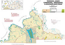
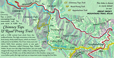
 Great Smokies Trail Atlas

 Cumberland Gap Map
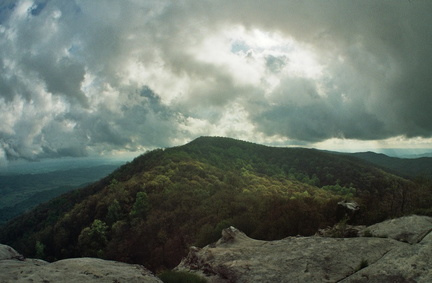 White Rocks Overlook
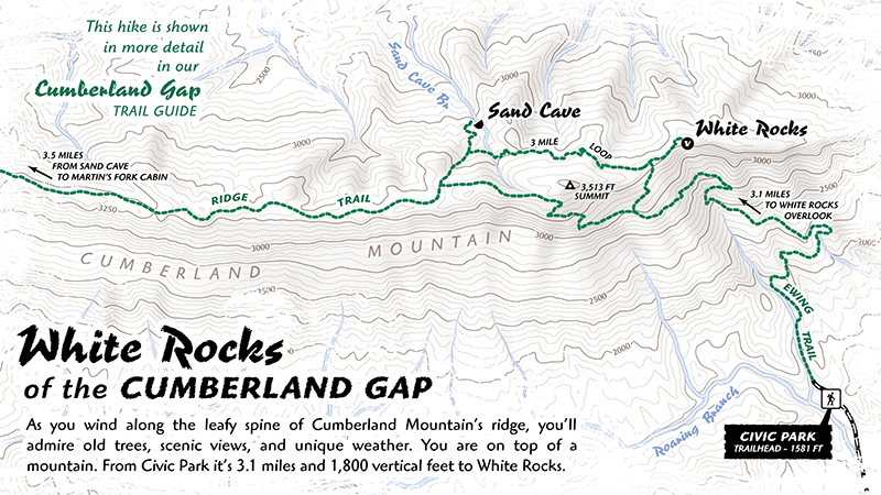
 We are proud to have contributed to the recent Daniel Boone National Forest magazine, The Boone Trace. This comely tabloid-sized full-color magazine is the U.S. Forest Service’s official visitors’ guide and welcome publication with maps, photographs, and timely information. With over 700,000 acres, 100+ developed recreation sites, and 600+ miles of trail, this national forest provides ample opportunities to refresh, reconnect and challenge yourself in the great outdoors. The Boone’s Trace magazine is free and should be the first document you read before your adventure in the forest.
 Turkeyfoot, S-Tree, and the Laurel River Lake. While forest ownership less continuous in this district, many trails (official and unofficial) spline the ridges and creeks for hikers, mountain bikers, and motorized vehicles.