This bridge was once part of the Sheltowee Trace. Today, you can find this near mile marker 34. Find more images of the Sheltowee Trace on our Flickr page.
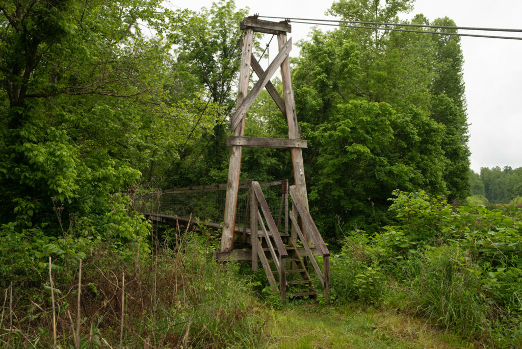
This bridge was once part of the Sheltowee Trace. Today, you can find this near mile marker 34. Find more images of the Sheltowee Trace on our Flickr page.
Winner: Best Spatial Analysis at the 2023 Kentucky Association of Mapping Professionals annual conference.
This analysis shows the difference between two digital surface models (DSM) created from lidar point cloud data hosted by KentuckyFromAbove.gov. DSMs allow us to visualize surface features like buildings and trees. The calculation subtracts the 2010 DSM from the 2019 DSM to find the height difference. The resulting raster layer is multiplied over a shaded relief base map from the 2019 DSM.
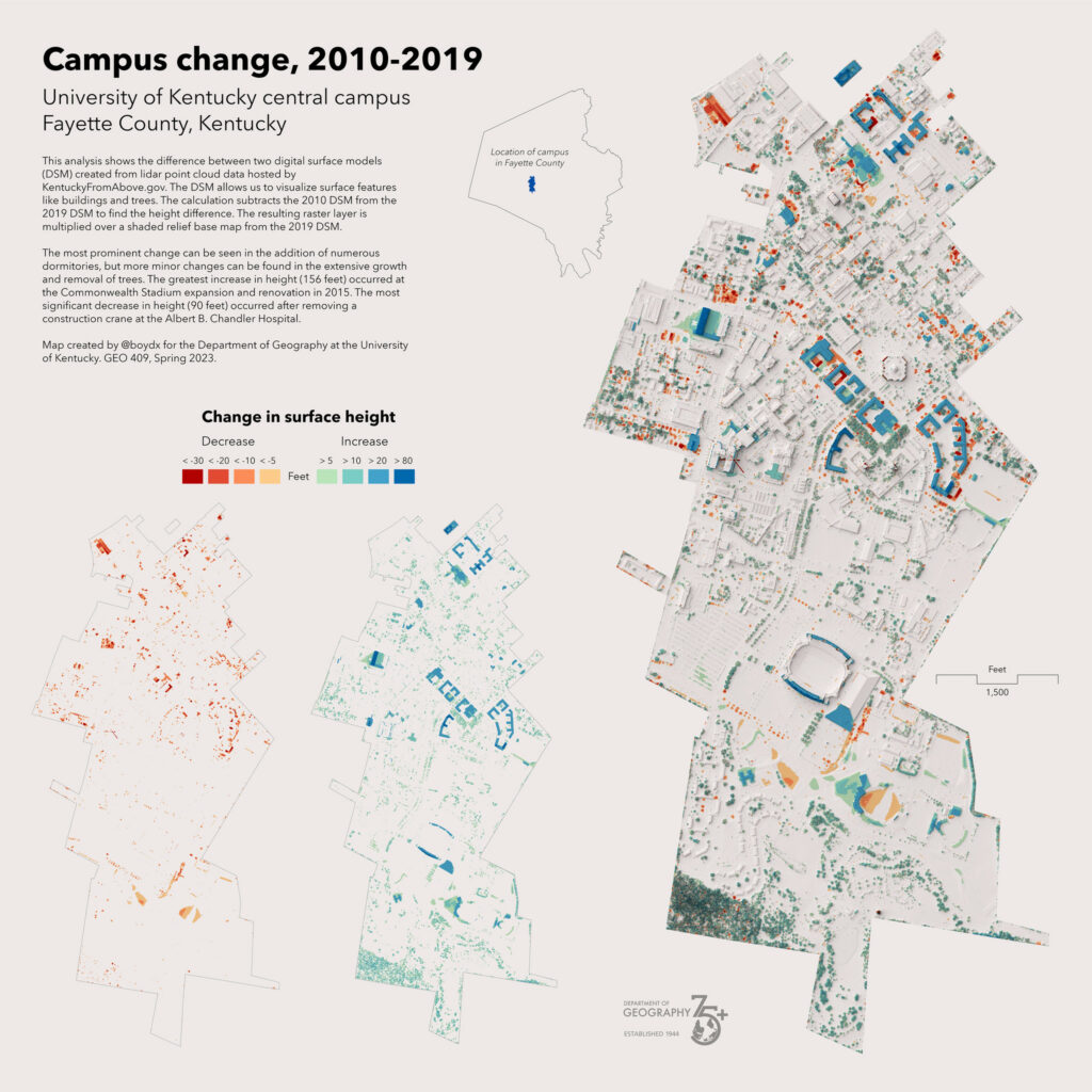
The most prominent change is the addition of numerous dormitories, but the more minor changes are the extensive growth and removal of trees. The greatest increase in height (156 feet) occurred at the Commonwealth Stadium expansion and renovation in 2015. The most significant decrease in height (90 feet) occurred after removing a construction crane at the Albert B. Chandler Hospital.
View map and other visualizations of change: https://boydx.github.io/uky-campus/
@boydx Department of Geography at the University of Kentucky. GEO 409 Spring 2023.
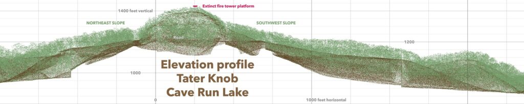
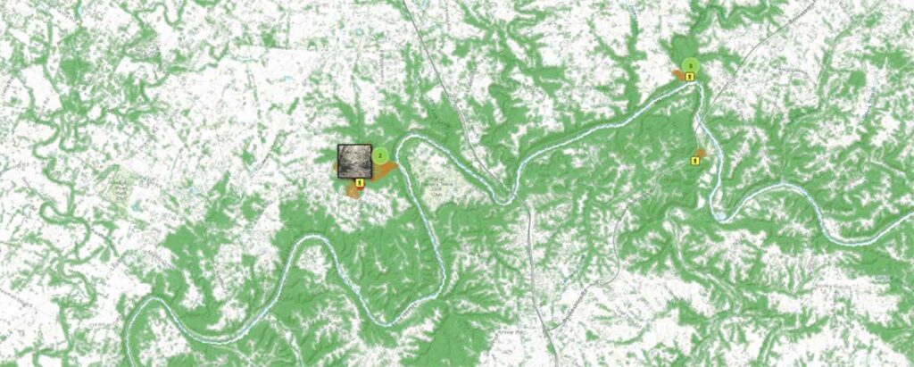
Cave Run in winter offers excellent off-trail exploration. Sheltowee Trace North Trail Map
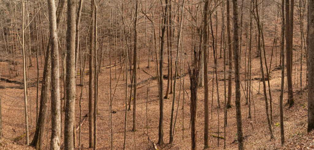
The unique topography of the area offers wide valleys near the lake and steep ridge tops with a scattering of knobs and cliffline.
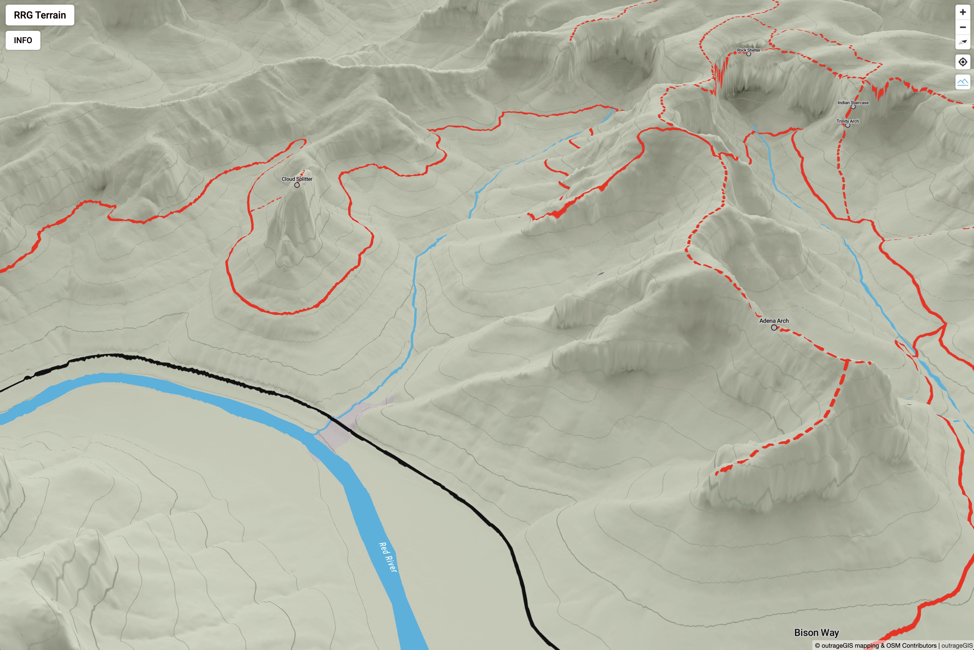
Interactive web maps have come a long way over the years. First we had slippy maps using raster tilesets – they’ve been around for about twenty years and are incredibly durable. However, once the tileset is rendered, it’s not easy to change the look of the raster image. You will need to render a new tileset and replace the old. Because a tileset can contain millions of images, it’s not a quick replacement.
Gaming technology evolved in the browser and brought us WebGL and vector tilesets. These tileset features have attributes and are rendered programatically in the browser. It’s rather easy to change the appearance of a feature and Mapbox built a browser application, Studio, to create endless styles of maps using vector features. What’s not easy is serving a vector tileset to a client until recently. Libraries like PMTiles bundle a vector tileset into a single file that expose the necessary to the client browser.
More recently, elevation (terrain) tilesets have made 3D maps more exciting to create and explore. Once an elevation is loaded, all other layers, tilesets, etc. are draped over elevation surface. Depending on the resolution of the elevation data, this surface can dramatically change the appearance of the map.
Using an open source mapping library like MapLibre GL JS, a browser can simultaneous consume raster, vector, and terrain tilesets to make a 3D map for any place you have data. Kentucky has excellent data availabilty including lidar data to make high-resolution elevation surfaces. This map uses that lidar data to create the terrain tileset and a shaded relief raster tileset. The vector tilesets for trails, roads, etc. are derived exclusively from OpenStreetMap. The water layers are from the USGS National Hydrological Dataset.
Below is a screen capture of the web page and a link. You might notice that it doesn’t have all of the trails that our printed maps show. We may add those trails in the future, because it would helpful for planning your trip. And, we’re not planning to move to an exclusive mobile app. With all of the advances in mobile technology, we think paper maps are still essential for learning basic navigation and map reading.
Happy adventures!
An analysis of flood-prone infrastructure and conditions in selected Eastern Kentucky watersheds.
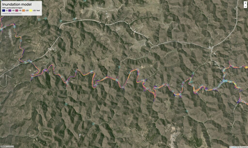
View maps and report: https://uky-gis.github.io/geo509/report-2022
Department of Geography, University of Kentucky, College of Arts and Sciences
December, 2022
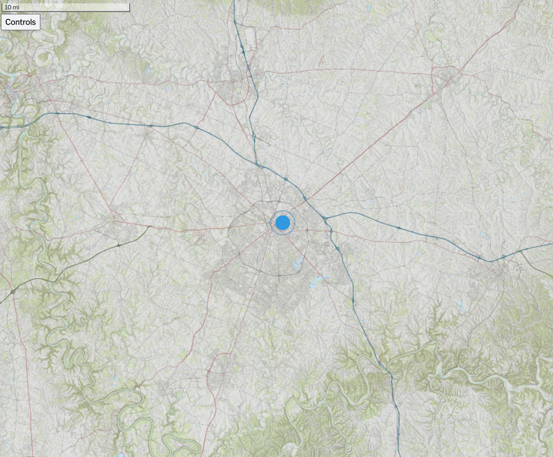
If you visit this site often, you likely have a favorite map app on your phone. I certainly do and I have installed dozens of apps over the years. Most focus on placing your location as a dot on the map.
Any map app that shows your location as a dot on the map fosters a dependence on your exact location. We end up saying, "I am here" instead of asking "Where am I?"
To build strong spatial awareness, we should look at the dot after studying the plain map and doing an exercise in terrain association. Can we orient the map (best done with a paper map, folks) so that map north aligns with observed north? Can we then identify features on the map and estimate their distance from us?
These are questions in topograhic map reading. If you carefully observe your environment and compare its representation on the map, you will not need the dot.
Let’s say the early 1990s. Before that time, we used paper maps. Soon after, handheld GPS units became popular and only showed coordinates for your position and maybe some other location statistics like speed, elevation, distance & bearing to next waypoint. They were often used with a paper map that had a grid (with linear units on a flat space) or a graticule (angular units on a curved space) that helped a user measure their location.
Using coordinates, we looked at the paper map’s margin for marks that pointed you to a general location. To find the exact location, we looked up and asked, "Where am I?" and compared the map with what we saw. We built a mental map of our surroundings. There was no dot.
So, we thought we would kick it back to the 90s and make a browser app that mimics these early devices. Because our maps have detailed graticules and mile markers for the Sheltowee Trace, this app should compliment your journey into topography and map reading. This app is designed for mobile devices and below is a screen capture of a use on an iPhone.
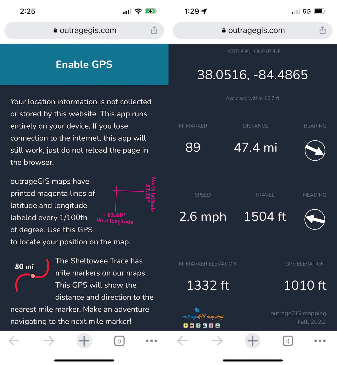
This app is free, open source, doesn’t need to be installed, and won’t collect any information from you.
Happy adventures!
Looking for a place to hike in the central Bluegrass? Check out this old-school style interactive map: https://www.outragegis.com/maps/bluegrass/
We have a lot of great raster base map services available in Kentucky and I wanted to access them for my current location when I use my mobile device in the field. While there are many ways to make a mobile map, I wanted use Leaflet JS and build a custom geolocation service using the Geolocation API. Some desired features for the web page:
The below screen capture shows the control panel for selecting base map and enabling the the location services. It also gratuitously adds content from the last three posts to this forum. (Practicing with Tailwind CSS for potential site redesign.)
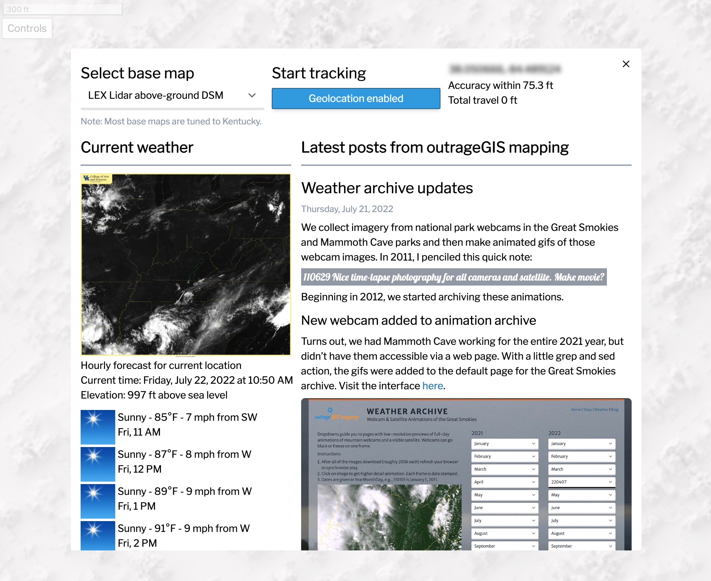
Please feel to add your comments and tell how it works on your mobile device. It has tested on Chrome and Safari mobile browsers.
Some caveats.
 Above is an screen capture of the Kentucky Topo map for the state. Other base maps include, lidar-derived surface models and current GOES-16 imagery.
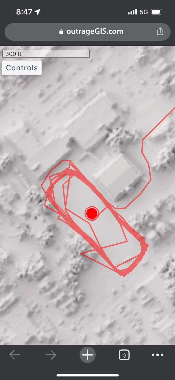 Screen capture of track mapping on a mobile device
We collect imagery from national park webcams in the Great Smokies and Mammoth Cave parks and then make animated gifs of those webcam images. In 2011, I penciled this quick note:
110629 Nice time-lapse photography for all cameras and satellite. Make movie?
Beginning in 2012, we started archiving these animations.
Turns out, we had Mammoth Cave working for the entire 2021 year, but didn’t have them accessible via a web page. With a little grep and sed action, the gifs were added to the default page for the Great Smokies archive. Visit the interface here.
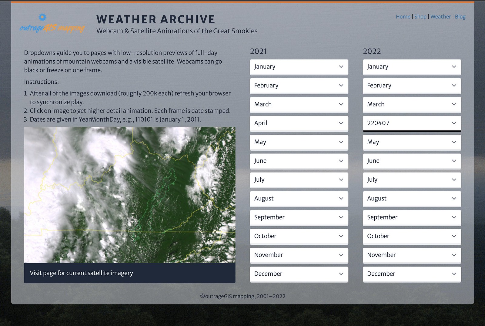
We plan on having at least the last year covered in the archive. At 60 GB a year now with HD cameras, it can get expensive hosting multiple years. I do have the years back to 2012 stored offline.
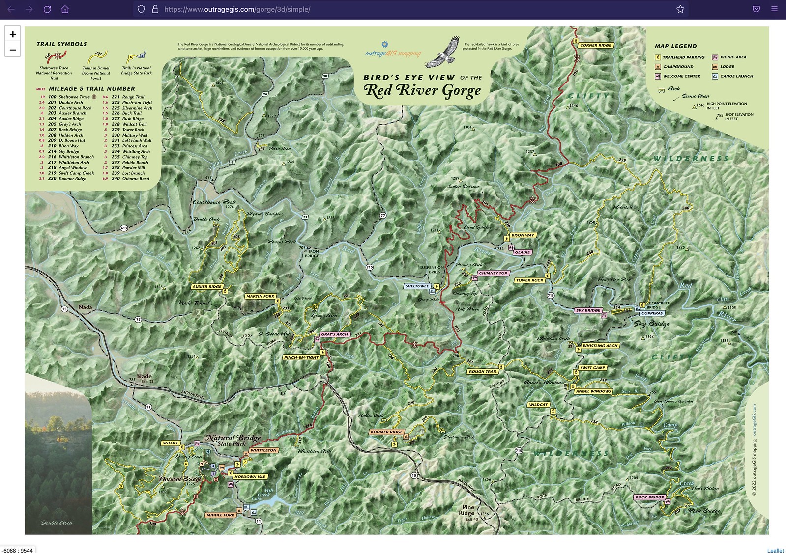
Over the past spring, we’ve been revamping our popular map for the Red River Gorge. The map should be available in early June. One of the additions is a new Bird’s Eye View map that user lidar elevation data and Blender 3d modeling software. You can view a zoomable image with this link
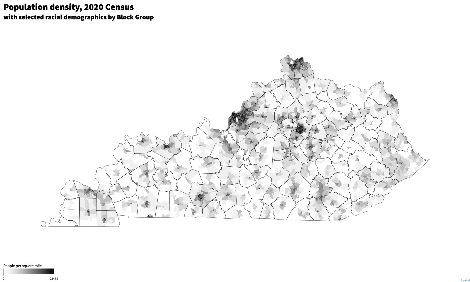
Time to explore the data on a map. The experiment is show block group data for select demographic data, which was used for redistricting. This interactive presentation is a test of concept to show population density. Eventually, an UI element will be added to symbolize block groups by precent population in self-identified racial group – as defined in Census categories.
After a few weeks fiddling with the Blender 3D application to make smooth shaded reliefs, I decided to create raster tilesets that could be used with web mapping applications for a unique look. While the shading is not as accurate as multidirectional shading techniques used in GDAL and ArcGIS Pro, it makes a more artistic rendering.
To view a web page with samples, check out boydx.github.io/hugo-maps and also learn about the New Maps Plus program at the University of Kentucky).


Back in the early 2000s, this popular messaging board (and others like it) was where online interaction happened. Many were focused on local groups and activities. Then, Facebook, spambots, and more dangerous hacking emerged. These boards couldn’t keep up and users eventually found more immediately gratifying social media platforms.
I have taken two popular boards and retired most of their functionality. One can view posts, but cannot add new ones or search (sorry).


Please join us for our 17th year at the Woodland Art Fair. New to the fair this year is our Sheltowee Trace map set. We will have reduced prices for our popular map laminations and t-shirts, while they last!
To find us, walk to the Kentucky state icon on the following map:


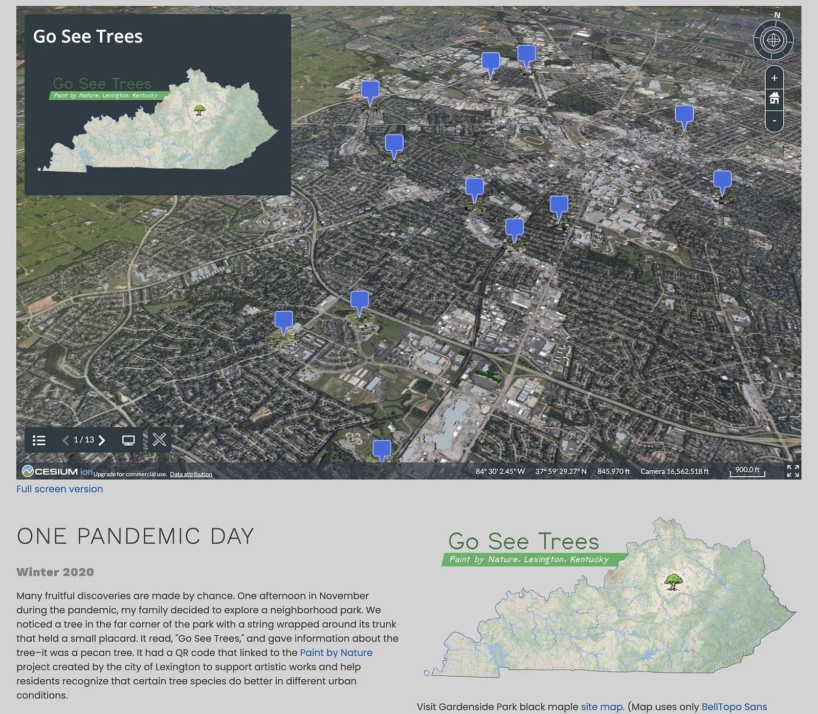
Lexington has a awesome fall event called, Paint by Nature, which encourages folks to create artwork around notable trees in the city. These trees aren’t necessarily the largest or showiest in their area, but are highly suitable plantings for their ecological settings.
While I didn’t make a submission, I did map the trees and used various lidar sources to visualize them. Visit this 3D visualization powered with Potree point cloud renderer. A growing list of similar visualizations can be found here.
Visit the trees in the Paint by Nature program on this page.