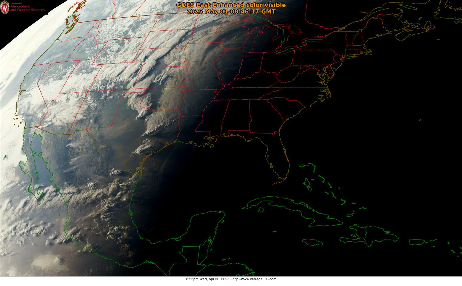
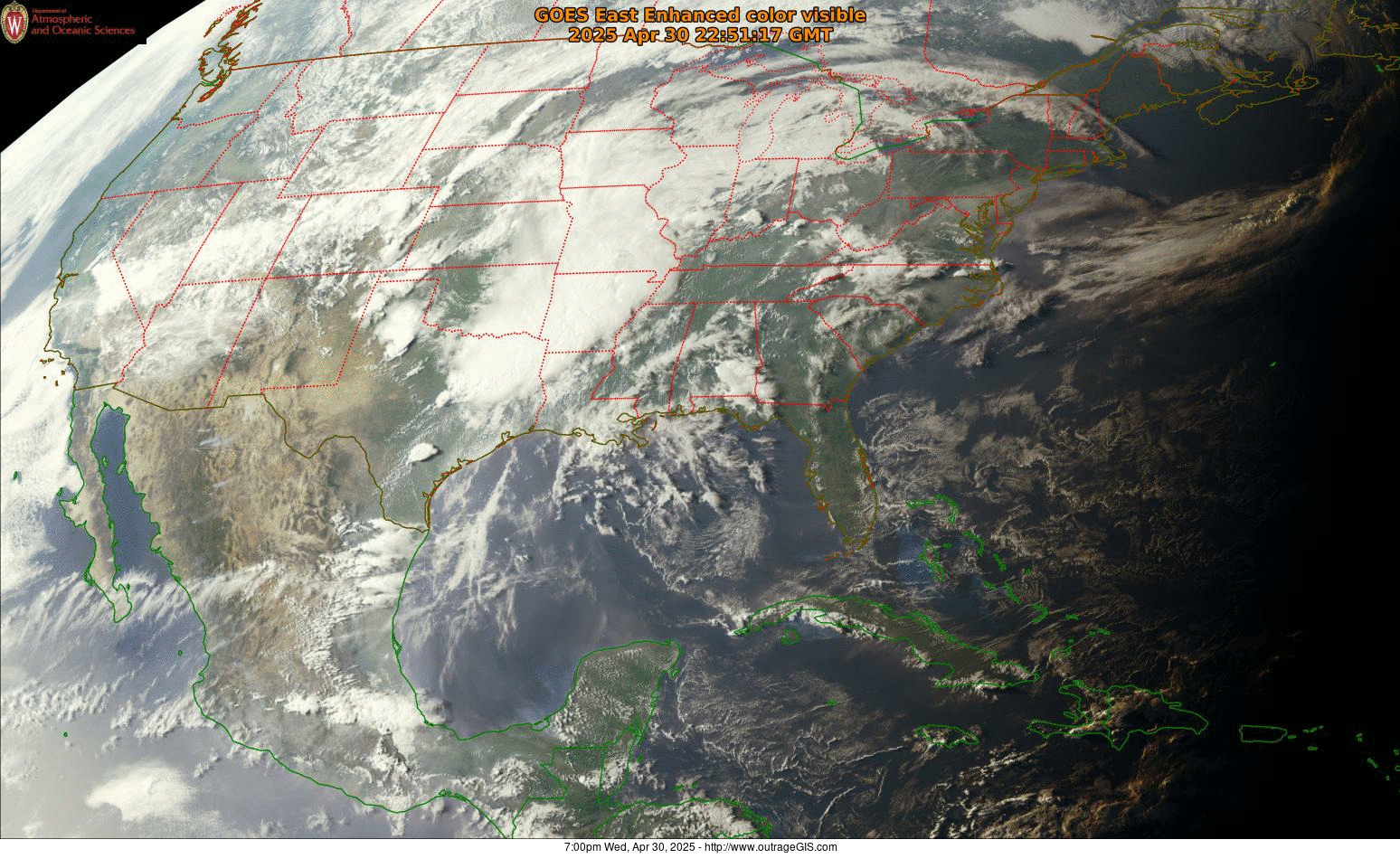
Downtown Lexington has a large number of chicken coops. A coop tour has been an annual event for years. In 2016 Floyd’s Farm & Home asked us to make a map of a tour centered on 6th Street. We used the artwork created by Homegrown Press (whose studio is located at 6th and Limestone) and tried to style the map in a similar fashion.
Elevation profile of connected interior spaces
It’s downtown Lexington, summer, and hot. Poor air quality and oppressive heat are hazards for older walkers and those with cranky babies. An interior (mostly air conditioned) pedway exists that connects various buildings downtown and is a walking convenience for many folks. When Lexington has more shady pedestrian paths away from city streets, walking inside wouldn’t be so inviting and necessary. [Read more…]
Cumberland Gap trail map at Woodland Art Fair, August 20-21
The update to our Cumberland Gap National Historical Park is almost complete. Much like the old map, our 2016 version is a 1 inch to 1/2 mile scale map with 50-foot contours, trail elevation profiles, and GPS-mapped trails shown in vivid full-color printing. This year we added a layer that shows density of canopy coverage and GPS-mapped Caldwell Gap Trail. The size of the park has increased since our last update, so we’ve included most of the additional land. [Read more…]
East End Preservation Project map
Base map for Salt Lake City hiking
A client needed a base map for an upcoming hiking guide to areas east of Salt Lake City. We came up with a simple, clean photoshop file using NAIP aerial imagery and 1/3 arc-second seamless DEM. The NAIP was used to create an NDVI and estimated canopy cover and the DEM was used as a shaded relief and to generate 40 ft contours. The NDVI and shaded relief were used for emphasis and helped make the aerial ‘pop’ a little more. Lakes and perennial streams were added, but as you can see the don’t register perfectly with the aerial image.
Norris Watershed Trail Map
Over the past year, we’ve refined a trail map for the City of Norris, Tennessee. The Norris Watershed Trail Map is probably printed by now and offers GPS mapped trails and mountain biking opportunities. The WPA era dam is pretty cool, too.
City of Rocks and 3D mapping offer teaching moment
With the quality of elevation data increasing, especially with the availability of LiDAR data, we have an opportunity to make unique visuals. Recently Wolverine Publishing needed maps developed for the climbing area, City of Rocks in Idaho. The project needed high-resolution maps and the data was available through public sources. We like making the physiographic base maps for recreation areas and this offered a special challenge. [Read more…]
Lexington Bike/Ped versus Car Collision Analysis
For a GIS course at the University of Kentucky Department of Geography (GEO 409), we mapped and analyzed the incidences of car collisions with pedestrians and bicyclists. Using data from Kentucky Crash Analysis Wizard (crashinformationky.org), we harvested collisions for Fayette County from January 2004 until April 8, 2016, the entire dataset at that point in time.
The website of collision maps is available here: http://boydx.github.io/collisions/ and the bike map is http://boydx.github.io/collisions/bikes
Lexington’s Urban Canopy
How much tree canopy covers the urban service area of Lexington, Kentucky? Inspired by the Davey Resource Group’s October 2013 study of canopy cover using 2012 NAIP imagery within Lexington’s Urban Service Area, a GIS class at the University of Kentucky created a similar, though limited, evaluation. [Read more…]
Pine Mountain Canopy Tour
What wild weekend and mapping task! Boyd led an undergraduate GIS class at the University of Kentucky and endeavored to map and analyze environmental tourism assets on Pine Mountain. During discussions with Pine Mountain State Resort Park, we discovered a canopy zipline tour, one of the first in the state, was being installed in the park. [Read more…]
Sheltowee Trace South, 2015
We’ve finished our Sheltowee Trace South, 2015 map. This rich color topographic trail map includes almost the entire Big South Fork National Recreation and River Area and the southern half of the Daniel Boone National Forest.
Map is six 19″ x 27″ pages and is available laminated. Check it out!