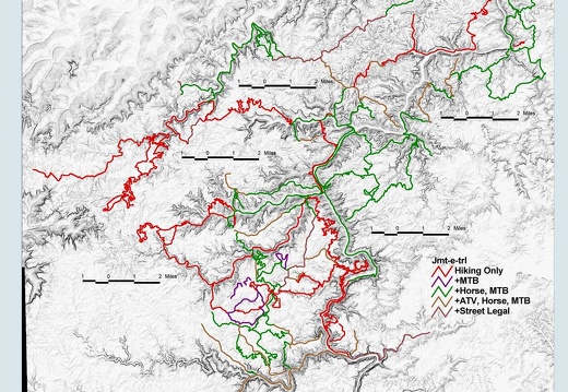
05 Nov 19: Big South Fork NRRA Trail Inventory
PRELIMINARY 051128 -- The inventory is complete and now we have an answer to, "Where has Pixel and his pals been in the Big South Fork?" Trails are mapped mostly with GPS, laid over a hillshade, and are categorized by use.The inventory is complete and now we have an answer to, "Where has Pixel and his pals been in the Big South Fork?" Trails are mapped mostly with GPS, laid over a hillshade, and are categorized by use. 343 miles of trail exist in NPS, USFS, and SP land that comprise the Big South Fork area. 146 miles are hiking only, 9 miles are hiking + mountain biking, 128 miles are hiking + mtb + equestrian, 37 miles are hiking + mtb + equestrian + atv, and 16 miles are connecting gravel roads. The first map from this trail database will be a guide to the 50-mile John Muir Trail. **Note: This inventory does not consider important areas north of Blue Heron (Yamacraw, Yahoo, etc...) but that trail network has been GPS mapped.
This area is covered in our Big South Fork Trail Map:
[img]http://www.outragegis.com/store/images/T/th_BISO_Cover-125w.jpg[/img]
Buy this map

05 Nov 18: The Dame, Lexington, KY
Friday night in the big city after Gallery Hop. Caitlin Cary and Thad Cockrell, a neo-classical 70s country duet (web), gave a memorable, moving performance. Couples embraced and appeared transfixed by their high-Friday night in the big city after Gallery Hop. Caitlin Cary and Thad Cockrell, a neo-classical 70s country duet (web), gave a memorable, moving performance. Couples embraced and appeared transfixed by their high-lonsome, lilting harmonies. My freelancing bud Dave (web) handily had a sweet slr camera and let me snap a few inebriated shots after the show. He shot the slide guitarist. These images really show the quality of a high mega-pixel camera and the superb optics of a pro lens...but you gotta cough up the cabbage.
05 Nov 12: Upper Rock Creek, Pickett State Park, TN
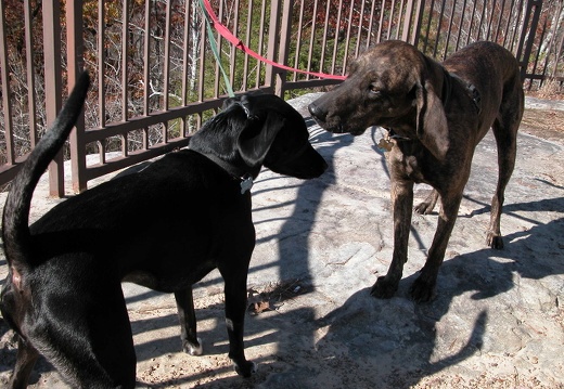
The 50-mile John Muir Trail terminates in Pickett State Park at the head of Rock Creek on Black House Mountain Road. The trail continues a few miles to Old Wagon Trail Road, skirting above Williams Creek through a series of mini slot canyons. A beaver damThe 50-mile John Muir Trail terminates in Pickett State Park at the head of Rock Creek on Black House Mountain Road. The trail continues a few miles to Old Wagon Trail Road, skirting above Williams Creek through a series of mini slot canyons. A beaver dam clogged about a quarter mile of Rock Creek and created a bayou-like area. The park has placed a few dubious boardwalk bridges across the deeper sections, some of which measured 5 feet in depth. Many ATV users ride Black House Mountain Road, which leads north to views overlooking the Pottsville Escarpment. Pixel had a new friend on this journey: Poco! and they walked about 14 miles and crossed Rock Creek about 50 times. Oy vey!
This area is covered in our Big South Fork Trail Map:
[img]http://www.outragegis.com/store/images/T/th_BISO_Cover-125w.jpg[/img]
Buy this map
05 October 22-24: Roan Highlands, Appalachian Trail, TN-NC
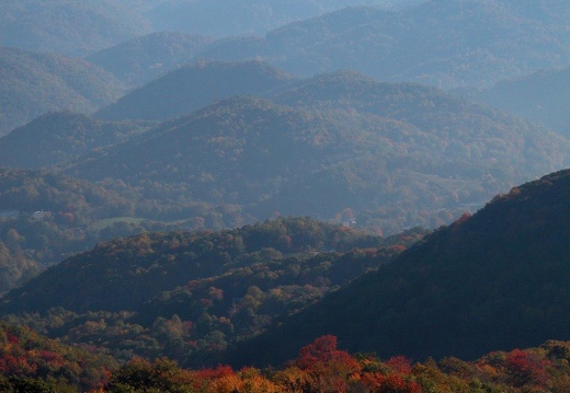
A 3-day hike along the Appalachian Trail from US 19E at Elk Park to the summit of Roan Mountain and back. Roughly a 34-mile hike with about 10k vertical feet of cumulative elevation gain. These are the Roan Highlands with a few peaks over 6,000 and sweepiA 3-day hike along the Appalachian Trail from US 19E at Elk Park to the summit of Roan Mountain and back. Roughly a 34-mile hike with about 10k vertical feet of cumulative elevation gain. These are the Roan Highlands with a few peaks over 6,000 and sweeping grassy areas, balds, that straddle the summit and offer great vistas of the southern Appalachian mountain range. Rhododendrons grow in massive clusters along the balds and fraser firs cloak the top of Roan. The specific challenge of hiking the highlands is weather. Our first day was halted two-thirds up Hump Mountain by strong winds, fog, rain, and approaching nightfall so we camped at Doll Flats...a superb camp. The next day was a classic fall day; exceptionally clear, warm, and dry...we got a little sunburned. That night the winds stirred from the south, then from the north, and by morning our tents were caked in sloppy ice. The temperature inside the tent was a nippy 20 degrees. A half-inch of hoar frost was found on exposed limbs and vegetation. Crossing the balds later that morning, we cut through thick fog and fierce winds were as loud as the slow drone of a bombing raid siren.
05 November 3-4: Bandy Creek, Big South Fork NRRA
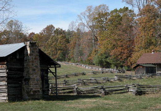
Bandy Creek is a popular area in the Big South Fork National River and Recreation Area. A homestead was abandoned here in early 1800s and the name "Bandy" is thought to be an abbreviation of saying, "Up on Abandoned Creek." Two great hBandy Creek is a popular area in the Big South Fork National River and Recreation Area. A homestead was abandoned here in early 1800s and the name "Bandy" is thought to be an abbreviation of saying, "Up on Abandoned Creek."
This area is covered in our Big South Fork Trail Map:
[img]http://www.outragegis.com/store/images/T/th_BISO_Cover-125w.jpg[/img]
Buy this map
Two great hiking trails begin here. The Oscar Blevins Farm Loop and the John Litton-General Slaven Farm loop are roughly 4 and 6 miles respectively. As the names imply, hikers visit preserved pioneer homesteads that families have lived in for generations. Both families left in the late 1970s when the park purchased the land, and neither farm had the benefit of running water or electricity. It's exceptional, and a little jarring, to discover that the park service is preserving the cummulated effect of settlement and not restored to fit into a prescribed historic period. You'll see old hand-hewn hemlock log cabins tacked 50 or 100 years later with tar paper and faux brick siding. Inside, newspaper was plastered as wallpaper and hardwood floors still moan under foot. Split-rail fences zig-zag around crop plots and walnut and pear trees litter the ground with their fruit. The Litton farm inspires awe when you imagine a family living in such a forlorn and beautiful valley.
This area is covered in our Big South Fork Trail Map:
[img]http://www.outragegis.com/store/images/T/th_BISO_Cover-125w.jpg[/img]
Buy this map
05 October 29-30: Mammoth Cave NP & West TN Halloween
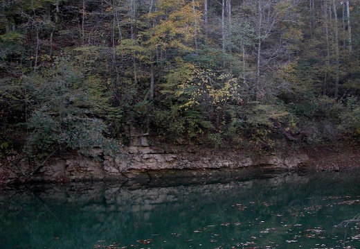
Mammoth Cave is a world heritage site because it is the longest mapped cave in the world (possibly up to 600 miles of passageways). Often overlooked, the backcountry trail system provides about 60 miles of hiking. The 9-mile Sal Hollow Loop Trail is the lMammoth Cave is a world heritage site because it is the longest mapped cave in the world (possibly up to 600 miles of passageways). Often overlooked, the backcountry trail system provides about 60 miles of hiking. The 9-mile Sal Hollow Loop Trail is the longest trail in the park, and one of few singletrack mountain biking trails found in Kentucky's national parks. The gentle grades and sinuous trail make a fast, great ride for a beginner. The Turnhole Bend trail follows a narrow ridge to large bend in the Green River. Due to numerous prodigious springs the river here is emerald green. Later that evening, I continued southwest to my father's place in west tennessee for a halloween gala and then further southwest to his ranch to check the deer feeding plot (turnips and mixed greens) and to witness a little target practice.

Blast from the Past: Portraits & Parks
A handfull of old sketches of parks and people in parks.

05 October 14: Gladie VC - Pinch 'Em Tight, Red River Gorge
The venerable power-loop hike under a Hunter's Moon in the Red River Gorge.The venerable power-loop hike under a Hunter's Moon in the Red River Gorge.
This area is covered in our Red River Gorge Trail Map:
[img]http://www.outragegis.com/store/images/T/th_Gorge.jpg[/img]
Buy this map
05 October 7-9: Wild Mountain Mania, Cumberland Gap NHP
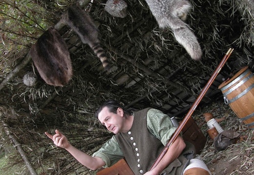
Although the weather turned sharply colder and windier on Friday, this national park nature festival enjoyed a good number of visitors learning about many aspects of our natural environment, such as birds of prey via a raptor rehabilitation program, backcAlthough the weather turned sharply colder and windier on Friday, this national park nature festival enjoyed a good number of visitors learning about many aspects of our natural environment, such as birds of prey via a raptor rehabilitation program, backcountry safety from the park service, and demonstrations of survival on the pioneer frontier. True to the title "Wild Mountain Mania," Cumberland Mountain was swallowed by dense clouds and evening camps were blustery and rainy, which all marked a melancholic start of autumn and the slow slide into winter's darkness. But just as the Cherokee, the colonial longhunter, and the lost black bear prepared for the cold and isolation of winter, so we too prepare today in fluorescent-lit malls, dark cineplexes, and garish holiday attire. But a season's weather will dismantle...Our calm...Drowning our last joyful chortle.
This area is covered in our Cumberland Gap Trail Map:
[img]http://www.outragegis.com/store/images/T/th_GAP-125w.jpg[/img]
Buy this map
05 Sep28-Oct01: Inland NC and Cliffs of the Neuse SP
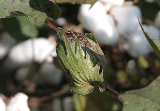
King Cotton and tobacco dominate the agriculture here. This area east of Goldsboro straddles the Piedmont and Coastal Plain physiographic regions of eastern North Carolina. Many of the old farm structures that remain represent a past of sharecropping andKing Cotton and tobacco dominate the agriculture here. This area east of Goldsboro straddles the Piedmont and Coastal Plain physiographic regions of eastern North Carolina. Many of the old farm structures that remain represent a past of sharecropping and the family farm. Although suburbia is encroaching from every direction, a few land owners seem to be preserving rural architecture in some capacity. The bramble-entangled mailbox standing open in front of World War II era farmstead is a sentinel of this lost past. The Neuse River cuts through the eastern edge of Piedmont leaving a 90-foot high cliffline of unconsolidated gravel, shale, sand, seashells and clay at Cliffs of the Neuse State Park. The cliffs were formed from a fault created by tectonic uplift from a receding ocean. Note the Lover's Lane section of the Park were lovers carved hearts of proclamation in a row of old beech trees. Maybe these lovers found their own gentle uplift in the park too.

05 September 30: Wayne County Fair, North Carolina
The county fair is not just carnival rides and funnel cakes. A traditional fair showcases the pride, creativity and industry of country life. While you can watch the Pig Race around the Red Barn, you can also wander through the Flower Show, the Art ExhibThe county fair is not just carnival rides and funnel cakes. A traditional fair showcases the pride, creativity and industry of country life. While you can watch the Pig Race around the Red Barn, you can also wander through the Flower Show, the Art Exhibit, and a working tractor engine display. The Beauty Pageant, where the 2005 Queen of the Fair was crowned, was a very popular event as the ladies were very cute. Southern country life of sprawling farms and families is slowly disappearing as land is parceled into subdivisions and kids move to larger towns. So the traditional fair represents a conflicted duality. The whirling lights and dizzying motion of pleasure-inducing machines illuminate the anachronism of rural independence.

05 September 24-28: Bogue Bank and Croatan National Forest, NC
The Beach @ Mom's. Bogue Bank is a 30-mile long, narrow island, or outer bank, that runs between Cape Carteret and Morehead City, North Carolina. We stayed on the western end of the island in a little town called Emerald Isle near Bogue Pier. Only this piThe Beach @ Mom's. Bogue Bank is a 30-mile long, narrow island, or outer bank, that runs between Cape Carteret and Morehead City, North Carolina. We stayed on the western end of the island in a little town called Emerald Isle near Bogue Pier. Only this pier survived hurricane Ophelia, which struck a few weeks prior and it suffered heavy damage. Two steel i-beams were chained across a gap to prevent the nose from falling into the ocean. The pier at Atlantic Beach was completely consumed by the raging sea. Days were occupied by jaunts down the beach, bikes across the sound, and strolls through pockets of forest in Croatan National Forest. Evenings afforded quiet walks and pleasant occasions in neighborhood eateries and bars. Since it was off-season, crowds were slim. We visited the communities of Indian Beach and Salter Path and notably ate a few wonderful oyster sandwiches at a little place called Flipperz. The island faces south into the Atlantic Ocean and makes for unique shoreline sun risings and settings, if only the weather cooperated everyday.

05 September 17-18: Midway Fall Festival
Midway is characterized as Kentucky's first railroad town. In 1831, the Lexington and Ohio Railroad Company began constructing a rail line between Lexington and Frankfort and at the midway point, this town was established. Many of the side streets are namMidway is characterized as Kentucky's first railroad town. In 1831, the Lexington and Ohio Railroad Company began constructing a rail line between Lexington and Frankfort and at the midway point, this town was established. Many of the side streets are named after L & O officials. The train still rumbles down the center of town today, and unfortunately as it did on Sunday, vehicles parked too close are hit. This art, food, and wine festival (three local wineries had booths) occupied the newly refurbished central block of Midway. People could choose from the usual fare of smoked pork bbq, funnel cakes and fresh-squeezed lemonade....or they could lounge on the patio of the Black Tulip or Bacchus flirting with their favorite libation. The eclectic nature of the shops, shop owners, and local artists & crafters made for a lively, friendly, and quite positive fair. John and I were happy to have a booth at this fair.
September 10: Martin's Fork, Red River Gorge
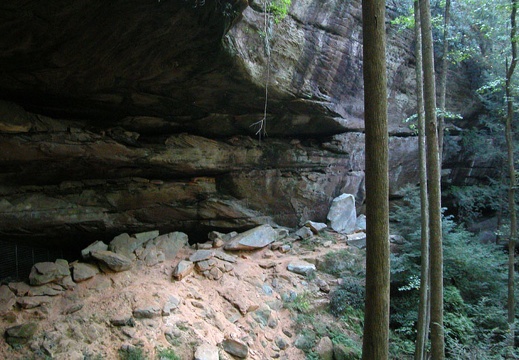
John and I restock maps for fall hiking in the Red River Gorge Geological Area. The Gorge offers great introductory experiences for overnight backpacking trips. With easy access to water, camping, and nearly a plethora of guides, maps, and websites, the gJohn and I restock maps for fall hiking in the Red River Gorge Geological Area. The Gorge offers great introductory experiences for overnight backpacking trips. With easy access to water, camping, and nearly a plethora of guides, maps, and websites, the gorge is one of the most scrubbed areas in the appalachian foothills. That said, we still saw a few parties that were utterly lost...without maps nor adequate provisions. The trails are all excellent singletrack that wind through hundreds of miles of scenic cliffline and often hang at the edge of rocky precipices. Each year the gorge claims the lives of a few inexperienced or unfortunate hikers who tarry too long at the edge. Memorials are found throughout the park. We started at Martin's Fork, then to Gray's Arch, Rush Ridge, Daniel Boone Hut and back to start: 6 miles.
This area is covered in our Red River Gorge Trail Map:
[img]http://www.outragegis.com/store/images/T/th_Gorge.jpg[/img]
Buy this map
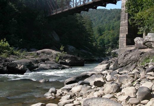
September 2-3: Southern John Muir Trail, Big South Fork
A solo excursion on the best foot trail in the Big South Fork and the Daniel Boone country -- the John Muir Trail. This 50-mile trail commemorates the life and wilderness explorations of John Muir, the father of our national park system. In September 1867A solo excursion on the best foot trail in the Big South Fork and the Daniel Boone country -- the John Muir Trail. This 50-mile trail commemorates the life and wilderness explorations of John Muir, the father of our national park system. In September 1867, Muir walked across Kentucky as part of his first epic wilderness journey, which began in Louisville, Kentucky and ended in Cedar Keys, Florida and later became the book, A Thousand-Mile Walk to the Gulf. The trail is symbolized with a blue silhouette of a bearded man with a hat. Each profile has a little different personality upon closer inspection. Hikers will enjoy many inspiring overlooks. I encountered 4 other solo backcountry packers who all marveled at their good fortune to commune with nature in such isolated and remote country, even on a busy holiday weekend. Saturday began at Leatherwood Ford, then onto Angel Falls Overlook, Grand Gap, Duncan Hollow, Station Camp Creek, and Laurel Fork Creek. Sunday began with coffee, then Station Camp Ford, Duncan Hollow Trail, Angel Falls Overlook, Onieda & Western Bridge, and then to the Leatherwood Loop and Overlook. Sunday found Jake mostly leashed due to abundance of copperheads. 38 miles total, with 22 unique miles of the John Muir Trail mapped.
This area is covered in our Big South Fork Trail Map:
[img]http://www.outragegis.com/store/images/T/th_BISO_Cover-125w.jpg[/img]
Buy this map
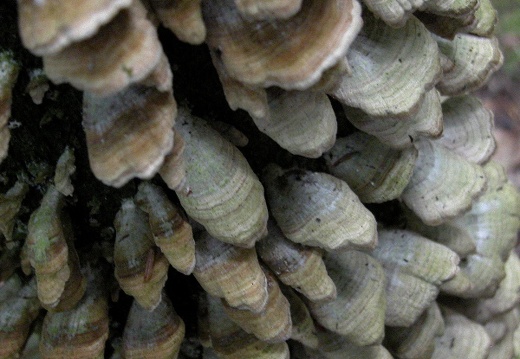
05 August 27: Hawk Creek Gorge & Chimney Rock
Sheltowee Trace at I-75 Exit 49 to KY-80 and back.Sheltowee Trace at I-75 Exit 49 to KY-80 and back.

05 August 20-21: Woodland Arts Fair
This 30th annual Woodland Art Fair was our first fair or outdoor event and we were surprised by the enthusiastic vibe. The turnout was aided by the fact that our location was completely in shade all day and our spot was the lowest in the area....a naturalThis 30th annual Woodland Art Fair was our first fair or outdoor event and we were surprised by the enthusiastic vibe. The turnout was aided by the fact that our location was completely in shade all day and our spot was the lowest in the area....a natural resting point. I guess geography matters. But the gears are in motion..... Our next scheduled event is October 7-9 at Cumberland Gap National Park's Wild Mountain Mania Nature Festival.

05 August 13: Little & Pilot Wines & Hurricane Creek Trails
The Big South Fork's Pilot Wines trail is a groomed, doubletrack horse trail that creates about a 15-mile loop with spur trails to the river. 6-mile Hurricane Creek trail is an unmarked trail that connects the river with Cub & Slavens Branch trails.The Big South Fork's Pilot Wines trail is a groomed, doubletrack horse trail that creates about a 15-mile loop with spur trails to the river. 6-mile Hurricane Creek trail is an unmarked trail that connects the river with Cub & Slavens Branch trails. Combined with the Big Island Loop, a trailer could enjoy a 30-mile figure-eight course with two fords accessing river islands. During the hottest summer days, a sparse few equestrians use these trails and today was no exception with noon temperatures hovering above 90-degrees. But as if by miracle, the sun receded behind a gray wash of clouds and a steady rain filled the forest with cold, foggy air. And to hear the pit-pat racket of rainfall descending through the woodland canopy is supremely calming, made more relaxing in the remote valleys of this park. Saw numerous turkey, deer, turtles and toads all of which gave much delight to the hounds....still waiting for the first bear....
This area is covered in our Big South Fork Trail Map:
[img]http://www.outragegis.com/store/images/T/th_BISO_Cover-125w.jpg[/img]
Buy this map

05 August 12: Kentucky River
Friends and Dogs escape Kentucky's summer with an evening walk to the Kentucky River via the Palisades. Headlamps provide the photo light source.
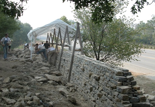
05 August 12: McAtee Run Dry Laid Stone Walling
Dry stone construction is an ancient craft of building structures without mortar. This wall is for Lexington's McAtee Run (mcateerun.com). For more info on dry stone, visit [url=http://www.drystone.org]drystone.org[/ur]Dry stone construction is an ancient craft of building structures without mortar. This wall is for Lexington's McAtee Run (mcateerun.com). For more info on dry stone, visit [url=http://www.drystone.org]drystone.org[/ur].

05 August 8: First Frontier Audio Driving Tour
Just out of our studio....John and I deliver the First Frontier Audio Driving Tour. This free (on-loan) tour package takes visitors on a 220-mile journey through Kentucky's Cumberland Mountians, "...For adventuresome spirits, the unexplored road lureJust out of our studio....John and I deliver the First Frontier Audio Driving Tour. This free (on-loan) tour package takes visitors on a 220-mile journey through Kentucky's Cumberland Mountians, "...For adventuresome spirits, the unexplored road lures you to rugged mountain settlements and luxuriant coves of rhododendron blooms. Autumn hues of amber and scarlet sweeten your memories of fall vacations. Springtime stirs enchanting old-time songs and the colors of redbuds and dogwoods in our mountain festivals...." Learn more here: firstfrontier.org.

05 August 6: Barren Fork & Railroad Fork
From U.S. 27 to KY 700 (and back) on the Sheltowee Trace passing numerous coal mines on Railroad Fork. NOTE: time stamp is 4.5 hours behind actual time....or something like that....still playing with new captioning feature.
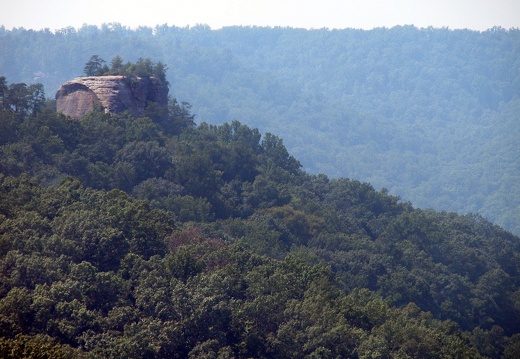
05 July 31: Up to Raven's Rock
A long-abandoned road up to Raven's Rock, a sandstone pinnacle, offers a quick & steep corridor to this extinct tourist attraction. When the Red River Gorge was being considered for flooding, this summit was thought to have resort appeal with its 360-A long-abandoned road up to Raven's Rock, a sandstone pinnacle, offers a quick & steep corridor to this extinct tourist attraction. When the Red River Gorge was being considered for flooding, this summit was thought to have resort appeal with its 360-degree vista. With 600 feet of elevation change in about a mile, this is one of the steepest walks in the Red River Gorge.
This area is covered in our Red River Gorge Trail Map:
[img]http://www.outragegis.com/store/images/T/th_Gorge.jpg[/img]
Buy this map

July 30: Troublesome and Difficulty Creeks, Big South Fork
From Ledbetter Trailhead to Divide Road to John Muir Trail and back to Ledbetter TH via the Kentucky Traill in the Big South Fork. The trail crosses Troublesome and Difficulty Creek, but with excellent trail conditions and great work by the park, this isFrom Ledbetter Trailhead to Divide Road to John Muir Trail and back to Ledbetter TH via the Kentucky Traill in the Big South Fork. The trail crosses Troublesome and Difficulty Creek, but with excellent trail conditions and great work by the park, this is one of the fastest hiking trails in the BSF. Suprising, and refreshing, not to see one person in 8 hours & 20 miles in this park on a saturday in july. Connects with the Sheltowee Trace below Standing Rock on Divide Road.

05 July 23: Triplett Creek, Bluestone, I64, Morehead, Oxley Br.
The Midland Trail, U.S. 60, connects Kentucky with Washington D.C. and follows Triplett Creek through Morehead. The Sheltowee Trace crosses a suspension bridge over Triplett and then follows the Midland Trail to an old road bridge and over to Bluestone. UThe Midland Trail, U.S. 60, connects Kentucky with Washington D.C. and follows Triplett Creek through Morehead. The Sheltowee Trace crosses a suspension bridge over Triplett and then follows the Midland Trail to an old road bridge and over to Bluestone. Unfortunately, the U.S. Forest Service does a poor job signing the trail as it weaves through the small hamlets that outlay Morehead. And a KY 38 roadcut west of Morehead abruptly terminates the trail with no signage. Just north though, the trail ascends to a ridge with excellent quadtrack that twists among stout and gnarled oaks and ashes, bent crooked by the ridge-top winds.
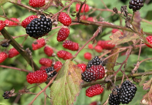
05 July 16: Turkey Foot, Resurgence Cave, War Fork, Arvel
The western approach to McKee along U.S. 421 is a steep, dramatic climb from the knobby outer-region of the Bluegrass to the Cumberland Plateau via the small hamlet, Big Hill. The Daniel Boone National Forest's topography here is the highest anywhere in tThe western approach to McKee along U.S. 421 is a steep, dramatic climb from the knobby outer-region of the Bluegrass to the Cumberland Plateau via the small hamlet, Big Hill. The Daniel Boone National Forest's topography here is the highest anywhere in the Forest, but with little of the deep, clifty relief found in its more popular areas. Many trails are opened to multiple atv-motocross use and make fast running quadtracks along ridges and gentle grades above streams. Below the Turkey Foot Recreation Area, the War Fork produces a large refrigerator-cold spring, Resurgence Cave. The Sheltowee Trace travels mid-elevation along the War Fork and rises up to Arvel at the Owsley County line where a weary hiker can find refreshment in an old country store and post office.
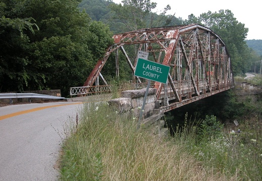
05 July 10: S-Tree to Wildcat Mountain
This 25-mile section of the Sheltowee Trace exemplifies much of ST found in the central Daniel Boone NF. The sequential trail condition: From S-Tree: gravel road, jeep trail, quad track, jeep trail, gravel road, hard top KY-89 and KY-490, then singletrackThis 25-mile section of the Sheltowee Trace exemplifies much of ST found in the central Daniel Boone NF. The sequential trail condition: From S-Tree: gravel road, jeep trail, quad track, jeep trail, gravel road, hard top KY-89 and KY-490, then singletrack, and then hardtop, gravel, jeep trail, gravel, and finally Wildcat Mountain.
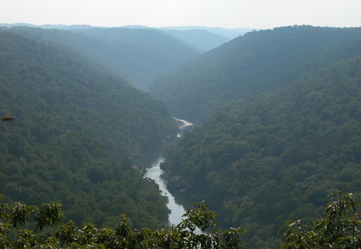
05 July 9: Cotton Patch Loop, Big South Fork
Located in the Bear Creek Scenic Area of the Big South Fork NRRA, the Cotton Patch Loop connects with Bear Creek Loop to make about 23 miles of unique, scenic solitude. These are mostly horse trails, but mountain bikers also can brave the tricky, steep asLocated in the Bear Creek Scenic Area of the Big South Fork NRRA, the Cotton Patch Loop connects with Bear Creek Loop to make about 23 miles of unique, scenic solitude. These are mostly horse trails, but mountain bikers also can brave the tricky, steep ascents out of the Big South Fork valley and the many minor tributary dips. Above, the trail is very fast. The trail accesses a low-water ford of Big South Fork. Except on cool and holiday weekends, the area is mostly vacant. Split Bow Arch is great.
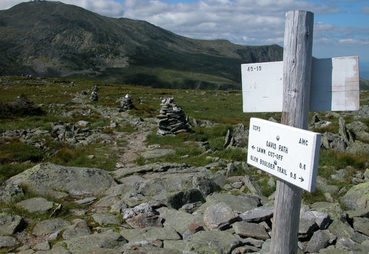
05 July 2-4: Presidential Range, White Mountains NF
The Presidential Range in New Hampshire forms a 12-mile mountain ridgeline with 8 peaks named after U.S. presidents. The highest 3 peaks are Mt. Washington at 6,288 feet, Mt Adams at 5,799 feet, and Mt. Jefferson at 5,716 feet. The average elevation changThe Presidential Range in New Hampshire forms a 12-mile mountain ridgeline with 8 peaks named after U.S. presidents. The highest 3 peaks are Mt. Washington at 6,288 feet, Mt Adams at 5,799 feet, and Mt. Jefferson at 5,716 feet. The average elevation change within 2 miles of the ridgeline is about 4,000 feet. The range has the greatest area above treeline, an alpine zone where extreme climate conditions prevent or stunt tree growth, of any place in the U.S. east of the Mississippi River. Other mountains are taller, such as the North Carolina Appalachians, but the Presidentials are 700 miles further north. The trails above treeline are marked by stacks of rocks, cairns, that are oddly attractive and sculptural and yet grim, like monuments to the many people who have perished above treeline in deadly weather. Mt Washington boasts the worst weather in world with an extreme low temperature of -47?F, wind gust of 231 mph, and a yearly snow total of 566 inches. The first day was Dolly Copp Campground (one of the largest U.S. Forest Service campgrounds) to Mt Madison via the Daniel Webster Trail, then to Madison Hut, Star Lake, Mt Adams, Madison Gulf, and the Great Gulf, a large glacier-formed valley. The second day was Pinkham Notch to Mt. Washington via the Boott Spur, then to Lakes of the Clouds Hut. You can drive to the top, even take a train, but the best way is by yourself, under your own locomotion.
05 June 26: Cumberland Gap National Historical Park
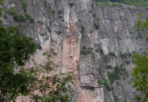
From the Civic Park to White Rocks in Cumberland Gap National Historical Park is a 3-mile hike with 1,900 vertical feet change, the greatest change in elevation for any Kentucky park hike, although the trail starts in Virginia and ends in Kentucky. WhiteFrom the Civic Park to White Rocks in Cumberland Gap National Historical Park is a 3-mile hike with 1,900 vertical feet change, the greatest change in elevation for any Kentucky park hike, although the trail starts in Virginia and ends in Kentucky. White Rocks is a 300-foot high cliff that served as a landmark for westward moving frontier settlers headed for the Cumberland Gap and the Bluegrass. Sand Cave is an immense sandstone overhang that forms a cave rockhouse with a deep sand floor. The itinerary was Civic Park to Cumberland Summit and Sand Cave via the Ewing Trail and the Ridge Trail, then to White Rocks Camp, White Rocks Overlook, and back to the Civic Park.

05 June 23: Mammoth Cave National Park
Mammoth Cave is the longest recorded cave system in the world. The land above the cave system exhibits many karst features, such as sinkholes, emerging underground rivers, and many cave entrances. The park has many miles of trails, including a soon-to-opeMammoth Cave is the longest recorded cave system in the world. The land above the cave system exhibits many karst features, such as sinkholes, emerging underground rivers, and many cave entrances. The park has many miles of trails, including a soon-to-open rail-trail from Park City to the Visitor's Center. Near the Visitor Center is a cemetery for old cave guides.

05 June 19: Pennyrile State Resort Park
The Pennyrile Nature Trail (PNT) is a 14-mile footpath that terminates in this state resort park. Recently Backpacker Magazine rated this the most difficult hiking trail in Kentucky. The trail is slightly difficult because it is needlessly twisty and littThe Pennyrile Nature Trail (PNT) is a 14-mile footpath that terminates in this state resort park. Recently Backpacker Magazine rated this the most difficult hiking trail in Kentucky. The trail is slightly difficult because it is needlessly twisty and little-used in parts, but it has none of the steepness, rocky surface, and remoteness found in eastern Kentucky trails. I'd like to come up with a formula for objectively classifying trail difficulty, more specialized than the Yosemite Decimal System, and kinda of like rock crawler and jeeper rankings. For example, a class A trail would be a flat, straight, hard-packed, even camber, well-marked, and always-perfect-weather trail versus a class F which would be a steep, twisty, severe off-camber, rocky, poorly-marked, and crazy weather trail. Here's how I'd like to start. Break each trail in .25 mile segments and measure slope, sinuosity, camber, surface condition, blaze status, and climatography. If a trail was GPSed then the data could be field acquired and a GIS could easily calculate slope, sinuosity and climatography, and field sampling could measure camber, surface condition, and signage. Sub-qualifiers could give classes additional information on quality of infrastructure, fords, and wildlife.

05 June 11-12: Sheltowee Trace, Laurel County
A web of quadtrack and jeep trails make up this section of the Sheltowee. From the head of Big Dog Fork to Highway 80 is runnable by dirt bike and, except for a few portions, atv. Itinerary: Kentucky Highway 192 at Laurel Lake to Highway 80 via PonderA web of quadtrack and jeep trails make up this section of the Sheltowee. From the head of Big Dog Fork to Highway 80 is runnable by dirt bike and, except for a few portions, atv. Itinerary: Kentucky Highway 192 at Laurel Lake to Highway 80 via Ponder Branch Bridge, Cane Creek Bridge, Vanhook Falls, East section of Rockcastle Narrows Loop, a ganglia of forest service roads, Big Dog Branch, Little Dog Branch, the hamlet of Bunch, Sinking Creek Suspension Bridge, Pine Creek Church Ridge, Pine Creek, Poison Honey Fork, and Hawk.
05 May 27-30: Sheltowee Trace, Big South Fork
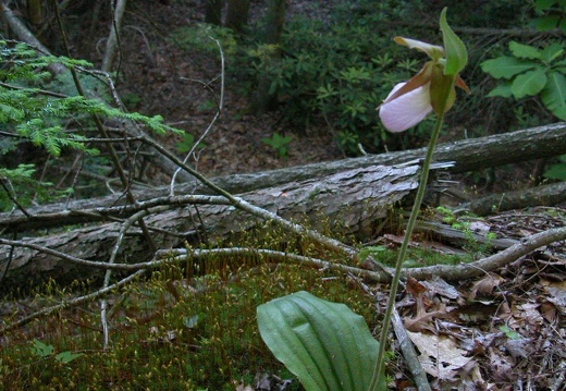
Pixel really showed his mettle on this 50-miler in the Big South Fork with a 10lb dog pack. Despite the heat, a long, waterless ridge segment, and raw, sore paws, he never winced and was always, "Forward! Look at that! What more can I do!?" I guPixel really showed his mettle on this 50-miler in the Big South Fork with a 10lb dog pack. Despite the heat, a long, waterless ridge segment, and raw, sore paws, he never winced and was always, "Forward! Look at that! What more can I do!?" I guess that's why they're man's best friend. We did have 2 days of complete solitude and had the occasion to sleep under a nest of owlets with the parent(s)? swooping in after hunting in valley with much noise. A pink lady slipper was found standing on an outcrop like a sentinel for the delicate, rare beauty of woodlands. While not pretty, this is important: I found a mangled sardine can. Why? The park deployed a transect of unopened sardine canisters to monitor the black bear population. A bear, or a human, are the only species that apparently can open a can of sardines. We use the key, but a bear rips it open with his powerful canines. A map is included and the itinerary was: the Sheltowee Trace from its southern terminus in Pickett State Park to U.S. Highway 27 at Flat Rock, approximately 45-50 miles, via Thompson Creek, Rock Creek, Gobbler's Arch, Divide Road, Laurel Ridge, Puncheoncamp Creek, Grassy Knob, Coon Patch Ridge, Grassy Fork, Sheltowee Ford of Rock Creek, Yamacraw Bridge, Negro Creek, Alum Ford, Yahoo Falls, Big Creek and Flat Rock.
05 May 21: New River Gorge, Bridge, Kaymor
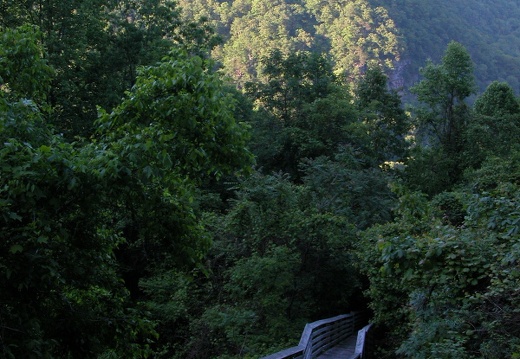
The New River is the only river the cuts through the ridge and valley province of the Appalachian mountains. Since the river existed prior to the uplift of the Appalachians, it created a 1,000 feet deep canyon bisecting the Appalachian chain. Look on thisThe New River is the only river the cuts through the ridge and valley province of the Appalachian mountains. Since the river existed prior to the uplift of the Appalachians, it created a 1,000 feet deep canyon bisecting the Appalachian chain. Look on this landform map and find the canyon in southcentral West Virginia. Interesting fact: rains that fall in northwestern North Carolina, the headwaters of the New, eventually flow into Ohio and Mississippi Rivers and into the Gulf of Mexico. The gorge exposes a few seams of coal and the now-extinct coal camp of Kaymor is along the New accessible via a long flight of stairs from mid-elevation between the valley floor and rim. Waterfalls can been seen across the gorge. The most thrilling moment was coming upon a mother bear and her 3 or so cubs around dust about 3/4 up the canyon near the abutments of the bridge. We stopped and looked at each for about 20 seconds separated by roughly 30 feet. She was snarfing the air, the dogs were fully alert, and the cubs quickly ran up a neighboring tree screeching in a worrisome way and the mother lumbered off down the canyon.